Bhagirathi–Hooghly River System

Ganga River System 09 Oct, 2026
Reader mode
Share:
My Saved
More
Shared
CognitoIAS Geography • UPSC / UPPSC / BPSC / WBCS

Bhagirathi–Hooghly River System: Complete Study Notes in English (PYQ-Enriched)

River System • Ancient Ports • European Trading Settlements • Historic Towns • Dams • Minerals • Industries

Revised Edition: Direct Riverbanks • Tributary Basins • Historic Monuments • Archaeology • National Waterway-1 • Irrigation • Industries.

These notes distinguish locations directly on the Hooghly bank, locations on tributary banks and sites in associated districts / river basins as separate categories. No examination year has been attached to a fact without checking the original question paper.
How to study correctly: Distinguish the Hooghly's direct tributaries, their sub-systems and towns situated in different river basins from one another. Do not regard Bankura, Purulia and Kharagpur as towns directly on the Hooghly.

1. Bhagirathi–Hooghly: Basic Identity

Bhagirathi–Hooghly: Western Distributary of the Ganga
River type: A distributary / distributary of the Ganga; not an independent river originating in the Himalayas.
State: Its main course lies only in West Bengal.
Upper course: Mainly called Bhagirathi; the name Hooghly is used from around the confluence with the Jalangi in Nadia district.
Course: Generally north → south; Murshidabad → Nadia → Hooghly/Howrah/Kolkata → southern estuary.
Mouth: Near the Sagar Island region, into the Bay of Bengal; a tidal estuary.
Special feature: India's famous riverine Port of Kolkata is situated on it, while Haldia forms part of its associated port/dock complex.
  • Farakka Barrage is on the Ganga; the 38.38-km feeder canal diverts Ganga water into the Bhagirathi (operational since 1975).

  • Farakka aimed to augment flow/navigation in the Bhagirathi–Hooghly and maintain suitable river flow for Kolkata Port.

  • The main river Bhagirathi–Hooghly, the district Hooghly and the town Hooghly–Chinsurah are three distinct geographic entities.

National Waterway-1 — Especially Important for Exams
Route: Haldia (Sagar) → Prayagraj: Ganga–Bhagirathi–Hooghly river system; 1,620 km.
Declared: October 1986; a major national waterway under the Inland Waterways Authority of India.
Significance: Haldia and Kolkata docks, inland freight transport, river navigation, and links up to Varanasi and Prayagraj.
Caution: The entire 1,620 km of National Waterway-1 is not the length of the Hooghly alone; it is a combined waterway spanning multiple rivers.

2. Complete River System (Essential River Connections)

Avoid the common mistake of calling every sub-tributary a direct tributary of the same main river.

Pagla–Bansloi Sub-basin

The Pagla–Bansloi drainage system originating in the Rajmahal plateau region belongs to the northwestern right-bank tributary basins of the Bhagirathi. It is distinct from the Babla–Uttarsan system around Kandi.

Bhagirathi–Hooghly

Ganga → Bhagirathi → Hooghly → Bay of Bengal

Mayurakshi / Babla

Mayurakshi–Bele + Brahmani–Dwarka + Bakreshwar–Kopai–Kuye → Babla–Uttarsan drainage → Bhagirathi (Kandi)

Ajay

Ajay + Kunur → Bhagirathi (near Katwa)

Jalangi

Jalangi → Bhagirathi (Nabadwip area); the downstream section is called Hooghly

Churni–Mathabhanga

Mathabhanga–Churni drainage system → Bhagirathi–Hooghly (lower Nadia)

Saraswati (historical)

An old branch/waterway of the Hooghly; linked to the historic port of Saptagram–Triveni

Damodar / Mundeswari

Lower branches of the Damodar → lower Damodar–Hooghly and Mundeswari–Rupnarayan connections

Rupnarayan

Dwarakeswar + Shilabati → Rupnarayan → Hooghly (near Geonkhali)

Haldi

New Cossye channel of the Kangsabati + Keleghai/Kalighai → Haldi → Hooghly (near Haldia)

Old Cossye Channel

Palaspai branch of Kangsabati/Old Cossye → Rupnarayan (a separate branch)

Remember: Do not write that the Kangsabati and Dwarakeswar rivers join the Hooghly directly. Rupnarayan and Haldi are separate intermediate rivers.
Map-reading caution: The river sequences below represent the order of river flow for understanding, not a scale map of geographic distances or directions. For the state's actual river-basin map, refer to West Bengal Irrigation Department — River Systems .
Which river should NOT be regarded as a Hooghly tributary?
The Subarnarekha flows through Jharkhand–West Bengal–Odisha and empties directly into the Bay of Bengal.
The Ajay, Damodar, Rupnarayan, Haldi and Mayurakshi drainage can be linked to the Hooghly, but it is incorrect to call each one a 'direct' tributary.

3. Major Towns and Monuments Along the Bhagirathi–Hooghly: North to South

Farakka and Jangipur — Murshidabad District
River: Farakka Barrage is on the Ganga; its feeder canal connects to the Bhagirathi.
Economy: Navigation, water supply and navigability for Kolkata Port, and NTPC's Farakka thermal power station.
Identification: Farakka 1975; feeder canal 38.38 km.
Murshidabad / Lalbagh
River: On the Bhagirathi; a major centre of Nawabi Bengal.
History: Murshid Quli Khan developed Maksudabad/Murshidabad as a capital; it became a major centre of the Nawabs of Bengal.
Monuments: Hazarduari Palace (Nawab Nazim Humayun Jah; architect Duncan MacLeod; 19th century), Katra Mosque (1723–24; Murshid Quli Khan), Nizamat Imambara (Feradun Jah; 1847), Khushbagh (tombs of Siraj ud-Daulah and Alivardi Khan), Jafarganj (Mir Jafar), Kathgola/Nashipur Rajbari.
Industries: Murshidabad silk, zari embroidery and handicrafts.
Cossimbazar and Berhampore
Identification: Historic silk-trading centre near Murshidabad, with European East India Company factories.
History: British, Dutch and French trading factories; Siraj ud-Daulah seized the British factory at Cossimbazar in 1756.
Sites: Cossimbazar Rajbari; Armenian Church at Saidabad; Berhampore cantonment — linked with early military discontent in 1857.
Palashi / Plassey
River: Historic battlefield in Nadia district near the Bhagirathi.
History: 23 June 1757 — Battle of Plassey; Siraj ud-Daulah versus the East India Company (Robert Clive), with Mir Jafar playing an important role.
Caution: Do not place it inside Murshidabad town; Palashi is a separate location.
Triveni–Saptagram and Kalna
River: Historic towns along the Bhagirathi–Hooghly river corridor.
History: Saptagram (Satgaon) — an important medieval trading port of Bengal. Silting in the Saraswati channel reduced commerce, and activity shifted towards Hooghly/Bandel.
Monuments: Triveni's historic pilgrimage confluence; Kalna (Ambika Kalna) — Rajbari complex and 108 Shiva Temples (Nava Kailash).
Kalna temples: Nava Kailash / 108 Shiva Temples, 1809 — Maharaja Tej Chandra Bahadur built them in two concentric circles: 74 outer + 34 inner temples.
Nabadwip and Krishnanagar
River: Jalangi–Bhagirathi connection around Nabadwip; Krishnanagar lies on the Jalangi.
History: Nabadwip Chaitanya Mahaprabhu (1486) is associated with his birth tradition and Nabadwip's scholarly centre of Navya-Nyaya logic.
Sites: Mayapur (ISKCON/Vaishnava tradition), Krishnanagar's clay idols, and Santipur's handlooms and Vaishnava culture.
Bandel and Hooghly — Portuguese Heritage
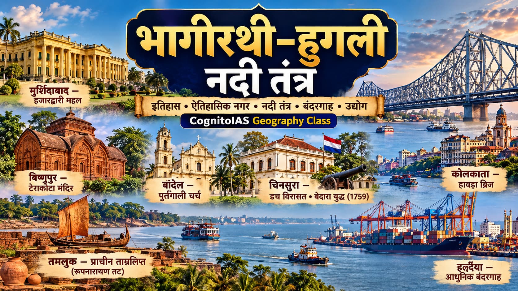
Colonial history: Bandel → Portuguese; Chinsurah → Dutch.
Monuments: Bandel Basilica: original church dated 1599, existing/rebuilt church from 1660; Hooghly Imambara: built during 1841–61 with support from Haji Muhammad Mohsin's trust; Dutch Cemetery in Chinsurah (a distinct historic centre).
Other: Hanseswari Temple at Bansberia; Hooghly district headquarters at Chinsurah.
Chinsurah (Chuchura) — Dutch Centre and Battle of Biderra, 1759
Location: Administrative headquarters of Hooghly district, West Bengal, on the western bank of the Bhagirathi–Hooghly. Hooghly and Chinsurah were historically separate settlements.
Dutch trade: The Dutch East India Company established a trading factory at Chinsurah in 1656. Textiles, silk and other products of Bengal were traded from here.
Battle of Biderra/Chinsurah: 25 November 1759, Dutch East India Company forces fought the British East India Company near Biderra, between Chandannagar and Chinsurah. The British land forces were commanded by Colonel Francis Forde; the British strategy involved Robert Clive. Outcome — British victory.
Sequence of the battle: 24 November 1759 saw naval fighting against Dutch ships in the Hooghly River, followed by the land battle near Biderra on 25 November. This defeat weakened the Dutch military challenge in Bengal.
Later history: British occupation in 1795, restoration to the Dutch in 1814, and transfer to the British in 1825.
Important sites: Dutch Cemetery, the former Dutch trading settlement and colonial architecture of Hooghly–Chinsurah.
Exam memory aid: Chinsurah = Dutch; Biderra = 1759; Forde = British land forces; 1825 = transfer of the Dutch settlement to the British. Keep this separate from Plassey (1757) and Buxar (1764).
Chandannagar
River: On the western bank of the Hooghly.
Colonial history: French settlement; de facto transfer to India in 1950 and legal transfer in 1952.
Monuments: Chandannagar Strand, Dupleix Palace/Museum, Sacred Heart Church.
Integration into India: 19 June 1949 referendum → 2 May 1950 de facto transfer → 9 June 1952 de jure transfer → 2 October 1954 integration into West Bengal.
Serampore
Colonial history: Danish settlement (Frederiksnagore); transferred to the British in 1845.
Education: Serampore Mission Press (1800), Serampore College (1818); Carey, Marshman and Ward.
Journalism: Samachar Darpan — 1818 (an early Bengali weekly); the regional tradition of the Mahesh Jagannath Rath Yatra.
Rishra — India's First Jute Mill
Location: Hooghly riverside industrial belt; Serampore subdivision, Hooghly district.
First industry: India's first jute mill — 1855; the jute industry subsequently spread along the Hooghly banks.
Exam fact: Rishra = 1855 = first jute mill; do not confuse it with Hastings Jute Mill, established in 1875.
Barrackpore — Revolt of 1857
Location: Cantonment town on the eastern bank of the Hooghly in North 24 Parganas.
History: Mangal Pandey and Barrackpore, 29 March 1857; an important site of early military rebellion in 1857.
Distinction: Berhampore (Murshidabad) and Barrackpore (North 24 Parganas) are two different cantonments.
Kolkata – Howrah
River: Kolkata is on the eastern bank; Howrah is on the western bank.
Monuments/history: Fort William (present fort, 18th century), Raj Bhavan (1803), Indian Museum (1814), Victoria Memorial (20th century), Jorasanko Thakurbari, Dakshineswar Kali Temple, Belur Math (Howrah bank).
Bridges: Howrah Bridge / Rabindra Setu (1943), Vidyasagar Setu (1992), Vivekananda Setu and Nivedita Setu.
Economy: Kolkata Dock System of Syama Prasad Mookerjee Port; Howrah's engineering industries; jute mills and river transport in the Hooghly belt.
Diamond Harbour / Raichak
River: Important riverbank and navigation area in the lower tidal reaches of the Hooghly.
Importance: Geography of riverine navigation, ship pilotage and the estuarine zone of Kolkata Port.
Geonkhali–Haldia–Sagar
Confluence: At Geonkhali, Rupnarayan → Hooghly; near Haldia, Haldi → Hooghly.
Economy: Haldia Dock Complex (Kolkata port system), IOCL Haldia refinery, petrochemicals, bulk cargo and water transport.
Mouth: Hooghly's tidal estuary → Bay of Bengal; Sagar Island and Gangasagar pilgrimage.
Inland Cultural Heritage: Hooghly and Neighbouring Bankura (Not on the Main Riverbank)
Radhanagar, Khanakul: Birthplace of Raja Rammohan Roy; Arambagh subdivision.
Kamarpukur: Birthplace of Ramakrishna Paramahamsa; Goghat-II.
Jayrambati: Birthplace of Sarada Devi; neighbouring Bankura district.
Caution: Do not describe these inland cultural villages as towns directly on the Hooghly River.
Two Geographic Regions of Murshidabad
Location: The Bhagirathi divides Murshidabad district into western Rarh and eastern Bagri regions.
Remember: The river is called the Bhagirathi; the divergence of Ganga–Padma and Bhagirathi also occurs in the Murshidabad region.
Exam fact • WBCS Prelims 2018View source
Murshidabad — Silk City of Bengal
River: Bhagirathi; historic capital associated with Murshid Quli Khan; Cossimbazar was a centre of European trade and silk textiles.
Economy: Murshidabad silk; study Hazarduari Palace and Katra Mosque as separate monuments.
Exam fact • WBCS Mains 2023 (exam held 2024)View source
Titagarh — Paper Industry
River/bank: Eastern bank of the Hooghly; district: North 24 Parganas; Barrackpore–Kolkata industrial belt.
Key exam fact: Known for the historic Titaghur Paper Mills; jute mills also existed here, but paper industry is the correct match in the question.
Exam fact • UPPSC 2013View source
Bhatpara — Jute Industry
River/bank: Eastern bank of the Hooghly; district: North 24 Parganas; associated with the Jagaddal–Kankinara–Naihati region.
Key exam fact: Centre of jute mills and jute textiles; the place is called Bhatpara, not 'Ghatpara'.
Exam fact • UPPSC Prelims 2013View source
Naihati, Kankinara, Jagaddal and Shyamnagar
Connection: Jute and other manufacturing areas of North 24 Parganas, on/near the Hooghly's eastern bank.
Remember Naihati as a town of the Kolkata–Hooghly industrial region; these places are in North 24 Parganas, not Hooghly district.
Exam fact • UPPSC Assistant Engineer Mains 2024 (held 2025): NaihatiView source
Barrackpore–Khardaha–Panihati
Connection: Eastern bank of the Hooghly, north of the Kolkata metropolitan region.
Barrackpore: 1824 cantonment mutiny and Mangal Pandey in 1857; Khardaha and Panihati: Vaishnava cultural sites in the northern suburban industrial belt.
Sodepur–Belgharia–Serampore: Textile Belt
Location: Sodepur and Belgharia are in the metropolitan industrial region; Serampore is on the western bank of the Hooghly.
In the question, all three were matched with the textile industry. Serampore's Danish colony, Mission Press and Serampore College are separate historical facts.
Exam fact • WBCS Mains 2023 (exam held 2024)View source
Dhaniakhali — Tant/Handloom Weaving
Location: Interior of Hooghly district, not directly on the Hooghly River.
Famous textile: Dhaniakhali tant sarees and handloom weaving; remember the town's distinctive economic identity.
Exam fact • WBCS Prelims 2019View source
Budge Budge — Jute and River-Based Industries
Location: Eastern bank of the Hooghly; district: South 24 Parganas.
A centre for jute, petroleum storage and related industries in the Kolkata–Hooghly industrial region; Bhilai is not part of this region.
Exam fact • UPPSC Assistant Engineer Mains 2024 (held 2025)View source
Falta — Export Processing Zone
Location: South 24 Parganas, on the lower Hooghly; an industrial area south of Kolkata.
The correct export processing zone (EPZ) in West Bengal for this question is Falta, subsequently developed as Falta SEZ.
Exam fact • WBCS Prelims 2021View source
Howrah–Hooghly: Bengal's First Passenger Railway Service
Date: 15 August 1854; East Indian Railway launched the service from Howrah to Hooghly.
Howrah–Hooghly is the correct pair in the question; India's first passenger railway was the Bombay–Thane service of 1853. Do not confuse them.
Exam fact • WBCS Prelims 2019View source
Gangasagar–Sagar Island
Connection: Mouth of the Hooghly River and Bay of Bengal; South 24 Parganas.
Kapil Muni Temple and Gangasagar Mela. Do not confuse Sagar Island with Majuli, the river island in the Brahmaputra.
East Kolkata Wetlands — Ramsar Site
Location: East of Kolkata; not on the Hooghly's main bank, but a wetland known for urban wastewater recycling.
Listed as a Ramsar site on 19 August 2002; known for fish farming and treatment-based wastewater reuse.
Exam fact • WBCS Prelims 2008, 2019, 2024View source
Lower Hooghly: Raichak, Diamond Harbour, Haldia
Raichak and Diamond Harbour are riverside locations on the lower Hooghly navigation route; Haldia is a port near the Hooghly–Haldi confluence.
Study Kolkata Port and Haldia Dock Complex as separate components; the lower Hooghly is a tidal river.

4. Mayurakshi–Brahmani–Dwarka–Kopai–Bakreshwar River System

Mayurakshi
Origin: Plateau region of Trikut/Deoghar–Dumka in Jharkhand; flows through Birbhum → Murshidabad in West Bengal.
Drainage: Mayurakshi–Bele, Brahmani–Dwarka and Bakreshwar–Kopai–Kuye drainage → Babla–Uttarsan → Bhagirathi (Kandi).
Dam: Massanjore / Canada Dam (Mayurakshi, Dumka, Jharkhand; the project also benefits the Birbhum region) and Tilpara Barrage (Mayurakshi, Suri, Birbhum).
Major places: Dumka, Suri, Kandi and the Birbhum–Murshidabad–Bardhaman agricultural region benefiting from irrigation.
Kandi–Hijol Beel–Babla–Uttarsan: The Actual Drainage Network
Three components: Mayurakshi–Bele • Brahmani–Dwarka • Bakreshwar–Kopai–Kuye.
Channels: The Brahmani–Dwarka and Bakreshwar–Kopai–Kuye channels are connected through the lower waterlogged Hijol Beel and Babla–Uttarsan areas to the Bhagirathi; branches and outlets may vary during monsoons/floods.
Flood management: Kandi Master Plan — a programme of embankments, drainage canals, sluices and measures to reduce persistent waterlogging across Murshidabad–Birbhum.
Note: Do not memorize these three names with arrows as if they were one straight, perennial river.
Tributaries and Towns
Brahmani–Dwarka: Drainage network coming from northern/southern and western Birbhum; Dwarka Weir (Deucha), Brahmani Barrage (Baidana); Tarapith lies near the Dwarka system in the Rampurhat region.
Kopai / Sal: The Kopai River of Bolpur–Santiniketan; the eroded red-soil Khoai landscape; Kopai Barrage (Kultor).
Bakreshwar: In Birbhum, Bakreshwar hot springs, Bakreshwar Shiva Temple/Shakti Peetha, Bakreshwar Weir (Kadisala), Bakreshwar Thermal Power Station.
Note: Distinguish Bakreshwar's hot springs from Bakreshwar Thermal Power Station; both are in the same region.
Birbhum — Cultural and Economic Significance
History: Rarh region; Santiniketan (Rabindranath Tagore; Visva-Bharati), Bolpur; Tarapith's religious traditions.
Minerals/energy: Basalt/black stone, stone crushers; Deucha–Pachami coalfield should be studied as a coal resource/project, not assumed to have a confirmed status of established production.
Other: Suri is an administrative centre; the Santhal community and many local village traditions are associated with Birbhum.
Santiniketan and Birbhum Archaeology — Cultural Connections
Bolpur–Santiniketan: Rabindranath Tagore; Visva-Bharati; associated with the eroded red-soil areas of the Kopai and Khoai (Khowai).
UNESCO: Santiniketan — World Heritage Site, 2023.
State geography: Santiniketan is not directly on the Bhagirathi–Hooghly main river; it is linked to the Kopai–Ajay–Mayurakshi region.
Tilpara Barrage — Direct Exam Fact
River: Mayurakshi; near: Suri, Birbhum.
Massanjore Dam is also on the Mayurakshi, but lies in Jharkhand (Dumka); remember their names and states separately.
Exam fact • WBCS Prelims 2020View source

5. Ajay–Kunur River System: Historic Ajay Valley

Ajay River
Origin: Chakai/Jamui, Bihar plateau region; then flows through Jharkhand and West Bengal.
Course: Forms a boundary in several stretches between Birbhum and Bardhaman; joins the Bhagirathi near Katwa.
Tributaries: Local drainage systems such as Kunur (Kunur) and Hinglo.
Important riverbank places: Jaydev Kenduli, Ilambazar–Bolpur region, Katwa and Ausgram.
Jaydev Kenduli — Ajay River
Location: On the bank of the Ajay River in Birbhum.
History: Jayadeva — Gita Govinda is associated with a local Bengal tradition; Kenduli Fair and Baul traditions.
Caution: There are different historical traditions in Bengal and Odisha about Jayadeva's birthplace; do not present Kenduli as his undisputed birthplace.
Pandu Rajar Dhibi — Chalcolithic Archaeological Site
Location: Southern bank of the Ajay River, Panduk village, Ausgram-II, Purba Bardhaman.
Archaeology: An important early Chalcolithic / Black-and-Red Ware site of West Bengal; evidence of prehistoric rural settlements and Chalcolithic culture.
Misconception: Its association with King Pandu of the Mahabharata is a local legend, not an archaeologically established identification.
Katwa and Bardhaman
Katwa: Ajay–Bhagirathi confluence region; associated with Chaitanya's initiation into sannyasa during the 1510s.
Bardhaman: Historic Burdwan Raj and rice-growing agriculture; Curzon Gate and 108 Shiva Temples (Nawabhat); Bardhaman town is not directly on the Ajay River.

6. Prehistoric Birbhum — Archaeological Sites

Mahishdal / Mahishadal — Chalcolithic Site (Birbhum)
Location: Northern/left bank of the Kopai River, near Santiniketan, Birbhum.
Finds: Chalcolithic objects and Black-and-Red Ware; Chalcolithic antiquities and evidence of early iron use thereafter.
Confusion: This is not the town of Mahishadal (Purba Medinipur).
Paruldanga, Shyambati, Ballavpur
Period: Mesolithic: microlithic tools, blade/microblade tradition.
Region: Kopai–Bakreshwar laterite uplands near Santiniketan; other listed sites include Chip-Kuthi and Bir Park.
Significance: The study of Paruldanga concerns Mesolithic life, tool-making and continuity of settlement.
Jibdharpur, Kotasur and Kirnahar
Jibdharpur: Site associated with Stone Age/prehistoric evidence in Birbhum; consult the available excavation evidence for its precise period and classification.
Kotasur: An archaeological site in the Mayurakshi region, associated with Black-and-Red Ware and studies of early historic settlement.
Kirnahar: Another Black-and-Red Ware/archaeological site in Birbhum.
Caution: Do not assign all sites to one period; Mesolithic, Chalcolithic and early historic evidence are different.
Exam connections: Ajay → Pandu Rajar Dhibi, Kopai → Mahishdal, Birbhum laterite uplands → Paruldanga/Shyambati/Ballavpur; these are distinct locations/periods.

7. Dwarakeswar–Shilabati–Rupnarayan System

Dwarakeswar / Dhalkishore (Dwarakeswar)
Origin: Elevated plateau region of Purulia; then extends through Bankura and the Hooghly/Paschim Medinipur region.
Tributary: Gandheswari (near Susunia–Bankura), Berai and other streams.
Towns: Bankura town — in the Dwarakeswar/Gandheswari region; Bishnupur — centre of the Malla dynasty near the Dwarakeswar.
Confluence: After the confluence of Dwarakeswar and Shilabati, the downstream river is called Rupnarayan.
Shilabati / Silai
Origin: Purulia district; flows towards Bankura and Paschim Medinipur.
Tributary: Small tributaries including Jaypanda.
Towns: Agricultural and flood-prone areas around Ghatal and Chandrakona; joins the Dwarakeswar near Ghatal.
Gangani (Garbeta) — Bengal's Vast Eroded Ravines
River: Shilabati / Silai; near Garbeta in Paschim Medinipur.
Landform: Rainwater erosion in reddish-brown soils produces gullies, ravines and badland features; popularly called Bengal's Grand Canyon.
Caution: Do not equate it geologically in scale with the Grand Canyon of Colorado.
Rupnarayan
Formation: Dwarakeswar + Shilabati confluence in the Bandar (near Ghatal) area; downstream, it is called the Rupnarayan.
Other inputs: The Mundeswari branch of the Damodar and the Old Cossye/Palaspai canal.
Towns: Ghatal, Kolaghat, Tamluk, Geonkhali.
Industries: Kolaghat Thermal Power Station; important river bridges and transport links via National Highway 16.
Mouth: Joins the Hooghly near Geonkhali.
Tamluk / Tamralipti — Ancient Port
River: Rupnarayan riverbank region, not directly on the Hooghly.
History: Ancient seaport of Tamralipti — connected with trade across the Indian subcontinent and Bay of Bengal, and with Buddhist travellers.
Monuments: Bargabhima Temple; Tamralipti Archaeological Museum; during the freedom struggle, Matangini Hazra and the Tamralipta National Government of 1942 (Satish Chandra Samanta and others).
Geography: The decline of the ancient port is mainly associated with sediment deposition and changing river–sea channels.
Chronology of 1942: 29 September 1942 — Matangini Hazra was martyred; 17 December 1942 — Tamralipta National Government was established (Satish Chandra Samanta, Sushil Kumar Dhara, Ajoy Mukherjee and others). These were separate events; do not describe Matangini as a serving leader of the government set up in December.
Ghatal Master Plan — Flood Geography
Basin: Shilabati–Dwarakeswar–Rupnarayan and lower flood-prone Kangsabati plains; Ghatal, Daspur, Panskura, Tamluk and Kolaghat areas.
Problem: Low-gradient plains, tidal interference with drainage, and flooding/waterlogging during rainfall.
Works: River excavation, embankments, drainage and sluice improvements; do not consider it merely a single dam project.
Shilabati and Gangani — Red Laterite Land
Location: Garbeta, Paschim Medinipur; eroded ravines of Gangani along the Shilabati.
Laterite soil, erosion and the nickname 'Grand Canyon of Bengal' are important; connect this site with the Shilabati, a tributary of the Rupnarayan.
Exam fact • WBCS Prelims 2020View source

8. Kangsabati–Keleghai–Haldi System

Kangsabati / Cossye
Origin: Chota Nagpur plateau region in Purulia; Bankura → Paschim Medinipur → Purba Medinipur.
Major tributary: Kumari, Bhairabanki and drainage connected with Tarafeni.
Dam: Mukutmanipur (Kangsabati Reservoir Project) — Bankura, in the Kangsabati–Kumari region; the project began in 1956–57.
Branches: Old Cossye/Palaspai channel → Rupnarayan; New Cossye channel → joins the Keleghai to form the Haldi.
Keleghai / Kalighai (Keleghai)
Origin: Drains from the Jhargram–Paschim Medinipur region.
Sub-tributaries: Kapaleswari, Baghai and Chandia.
Formation: Keleghai + New Cossye channel → Haldi River (Tangrakhali, Mahishadal region).
Haldi (Haldi River)
Course: Flows west to east through Purba Medinipur.
Mouth: Hooghly River near Haldia.
Significance: Haldia port–refinery–petrochemical hub and maritime transport.
Formation of the Haldi River — Cossye + Keleghai
The southeastern New Cossye channel of Kangsabati/Cossye and the Keleghai join to form the Haldi; the Haldi then meets the Hooghly.
The other, Old Cossye channel of Kangsabati is connected with the Rupnarayan system; do not say 'Kangsabati joins the Hooghly directly'.
Exam fact • WBCS Prelims 2022View source
Kumari River — Tributary of Kangsabati
The Mukutmanipur project is near the Kangsabati–Kumari confluence in Bankura.
Do not mistake the Kumari for a tributary of the Damodar or Ajay.
Exam fact • WBCS Prelims 2022View source

9. Bankura, Purulia, Medinipur: Towns, History and Geography

These locations are not on the Hooghly itself, but in its associated sub-basins or neighbouring plateau region.

Bankura — Dwarakeswar–Gandheswari Region
Geography: Rarh / eastern Chota Nagpur region; the Gandheswari River is connected to the Dwarakeswar.
Monuments: Susunia inscription — of Chandravarman, an early historic inscription; Susunia Hill and stone tools.
Economic fact: Terracotta Bankura horse, silk/handlooms, laterite, clay/stone and mineral-based industries.
Bishnupur — Mallabhum
History: Malla dynasty temple town; Bishnupur gharana, Baluchari sarees.
Temples: Rasmancha (Bir Hambir, around 1600), Shyam Rai (Raghunath Singh, 1643), Jor Bangla (Raghunath Singh, 1655), Madan Mohan (Durjan Singh, 1694); terracotta art.
Geography: Near the Dwarakeswar's course, not on the Hooghly main channel.
Purulia — Plateau and Minerals
Geography: Ajodhya Hills, Jhalda, Raghunathpur; headwaters of Dwarakeswar, Shilabati and Kangsabati in plateau areas.
Culture: Purulia Chhau (masked dance); Santhal, Bhumij and other communities.
Monuments: Garh Panchkot; Telkupi temples ruins in the Panchet Reservoir/Damodar region, not within the Haldi system.
Minerals: Rock phosphate (Beldih/Chirugora/Kutni), china clay/kaolin, quartz, base metals and building stone — location-specific resources, not all operating mines.
Medinipur / Midnapore and Kharagpur
Medinipur: Historic city in Paschim Medinipur associated with the revolutionary movement of the 1930s and colonial administration.
Kharagpur: IIT Kharagpur (1951), a major South Eastern Railway junction/workshop; do not locate it on the Hooghly River.
Birsingha–Ghatal: Birthplace of Ishwar Chandra Vidyasagar (1820); Ghatal region in the Shilabati–Rupnarayan system.
Jhargram: Forested plateau zone, headwater region of Keleghai/Kalighai and other local streams.
Karnagarh / Shiromani Garh — Chuar Rebellion
Location: Salbani area north of Medinipur; historic fort/temples near the Parang River.
History: Region associated with Rani Shiromani and the Chuar Rebellion.
Monuments: Mahamaya and Dandeswar temples at Karnagarh; these are not directly on the Hooghly.
Bankura — Red/Laterite Soil
Red and laterite soils occur in the Rarh region of Bankura–Birbhum, while alluvial deposition dominates the lower Hooghly plains.
Study soil–region associations alongside landforms; the plateau and deltaic terrain differ.
Exam fact • WBCS Prelims 2008: Laterite–BankuraView source

10. Major Dams, Barrages, Reservoirs and Power Stations

Farakka Barrage
Associated river: Ganga
Location/significance: Murshidabad; 1975; 38.38-km feeder canal towards the Bhagirathi
Jangipur Barrage
Associated river: Bhagirathi
Location/significance: Farakka complex; flow regulation
Massanjore / Canada Dam
Associated river: Mayurakshi
Location/significance: Dumka, Jharkhand; Mayurakshi Reservoir Project
Tilpara Barrage
Associated river: Mayurakshi
Location/significance: Suri, Birbhum; irrigation
Bakreshwar Weir
Associated river: Bakreshwar
Location/significance: Birbhum; Mayurakshi Irrigation Project
Kopai Barrage
Associated river: Kopai
Location/significance: Birbhum; Mayurakshi Project
Dwarka Weir
Associated river: Dwarka
Location/significance: Deucha, Birbhum
Brahmani Barrage
Associated river: Brahmani
Location/significance: Baidana, Birbhum
Mukutmanipur / Kangsabati Dam
Associated river: Kangsabati–Kumari
Location/significance: Bankura; project begun in 1956–57
Murguma Dam
Associated river: Sahrajor — a stream in the Kangsabati sub-basin, not on the main Kangsabati River.
Location/significance: Jhalda-II, Purulia; Sahrajor Irrigation Scheme / earthen dam.
Panchet Dam
Associated river: Damodar
Location/significance: Damodar system; Purulia–Jharkhand border; not on the Hooghly
Durgapur Barrage
Associated river: Damodar
Location/significance: DVC / irrigation; not on the Ajay or Rupnarayan
Power stations: Bakreshwar Thermal Power Station (Birbhum), Kolaghat Thermal Power Station (Rupnarayan), Farakka Super Thermal (Farakka), Haldia refinery/petrochemical complex — remember their distinct locations and associated rivers.
Three different structures: Farakka Barrage = Ganga; Jangipur Barrage = Bhagirathi; Feeder canal = canal supplying water from Farakka to the Bhagirathi.
Farakka Barrage — Main Exam-Relevant Purpose
River: Ganga; the 38.38-km feeder canal augments water in the Bhagirathi–Hooghly.
Purpose: To maintain navigability of Kolkata Port and improve flow in the lower Hooghly; it was not built primarily for generating electricity.
Exam fact • WBCS 2003, 2009, 2015, 2017; WBCS Mains 2023View source
India–Bangladesh Ganga Water Treaty
The India–Bangladesh agreement on sharing Ganga water at Farakka was signed in 1996.
Study Farakka Barrage and Ganga water-sharing in both geography and India–Bangladesh relations.
Exam fact • WBCS Prelims 2002, 2008View source
Farakka — Historical Arsenic Treatment Question
In a 2018 question, Farakka was identified as the location of a major arsenic treatment/purification plant in West Bengal.
This is a fact as framed at the time of that exam; do not claim it remains the state's 'largest operational plant' in 2026.
Exam fact • WBCS Prelims 2018View source
Mukutmanipur Dam — River Identification
River system: Kangsabati–Kumari; Bankura district, West Bengal.
Do not place the Kangsabati Project on the Damodar, Barakar or Dwarakeswar.
Exam fact • WBCS Prelims 2021View source

11. Minerals, Economic Centres and Agriculture

Resources and Industries by Region
Raniganj–Asansol: Gondwana coal, coal-bed methane; an industrial belt in the Damodar–Ajay region; Raniganj is not directly on the Hooghly River.
Birbhum: Deucha–Pachami coal resources, black stone/basalt, stone crushing, agriculture and handlooms.
Purulia: Rock phosphate, china clay, quartz and decorative stone; distinguish mineral resources from currently operating mines.
Bankura: China clay, laterite, stone, terracotta, Bishnupur Baluchari; Mukutmanipur irrigation.
Howrah–Hooghly–Kolkata: Jute mills (Hooghly industrial belt), engineering, foundries, warehouses, river port, railways and commercial services.
Haldia: Haldia Dock Complex, refinery, petrochemicals, fertilizers and bulk trade.
Murshidabad: Sericulture and weaving, handicrafts, alluvial rice and jute cultivation.
Rarh plains: Rice/paddy, canal irrigation, flooding and silt deposition in the lower valley.
Jute Industry — Rishra 1855
Exam fact: Rishra (Hooghly) → India's first jute mill → 1855.
Geographic factors: Hooghly waterway, availability of labour, nearby jute-producing delta, railways and Kolkata Port.
Kolkata–Hooghly Industrial Region: Exam Matching
Important associated towns: Naihati, Titagarh, Bhatpara, Rishra, Serampore, Budge Budge and Haldia.
Industries: Titagarh–paper; Bhatpara–jute; Serampore–textiles; Haldia–port/petrochemicals. Bhilai is in Chhattisgarh, not in this belt.
Exam fact • UPPSC 2013; UPPSC AE Mains 2024 (held 2025)View source
Murshidabad–Silk and Haldia–Petrochemicals
Murshidabad: historic silk area on the Bhagirathi; Haldia: port and petrochemicals at the Hooghly–Haldi confluence.
Remember both these towns' economic identities along with their river connections.
Exam fact • WBCS Mains 2023; earlier WBCS Prelims questionsView source
National Waterway-1: Prayagraj to Haldia
1,620 km along the Ganga–Bhagirathi–Hooghly system; declared National Waterway-1 in 1986.
Major ports/terminals: Haldia, Kolkata, Farakka, Berhampore, Jangipur and Triveni; earlier questions use the name Allahabad–Haldia.
Exam fact • UPPSC 2014View source
Bridges over the Hooghly: Remember Four Names Separately
Rabindra Setu = Howrah Bridge; Vidyasagar Setu = Second Hooghly Bridge; Vivekananda Setu = Bally Bridge; Nivedita Setu is the newer adjacent bridge.
Rabindra Setu and Vidyasagar Setu between Kolkata and Howrah both span the Hooghly; do not confuse the road and rail links.

12. Chronology of Historical Events

Ancient period

Tamralipti was an important ancient port; Chalcolithic settlements existed in the Ajay–Kopai region.

Around the 4th century CE

Chandravarman inscription at Susunia — Bankura.

7th century CE

Karnasubarna — capital of Shashanka (Gauda).

1599 / 1660

Bandel: old church / present reconstructed church.

Around 1600

Bishnupur Rasmancha — Malla period.

17th century

Dutch trading settlement at Chinsurah and European factories at Cossimbazar.

1723–24

Katra Mosque — Murshid Quli Khan.

1757

Battle of Plassey — Palashi.

175925 November: Battle of Biderra/Chinsurah — British forces commanded by Colonel Francis Forde defeated the Dutch.
1800

Establishment of Serampore Mission Press.

1809

Kalna's 108 Shiva Temples — Maharaja Tej Chandra Bahadur.

1818

Serampore College and publication of Samachar Darpan.

1841–61

Construction of Hooghly Imambara.

1855

Rishra — India's first jute mill.

1857

Barrackpore — Mangal Pandey; also remember the separate cantonment incident at Berhampore.

1942

29 September: Matangini Hazra martyred; 17 December: Tamralipta National Government.

1943

Howrah Bridge / Rabindra Setu opened.

1949 → 1954

Chandannagar: referendum (1949) → de facto transfer (1950) → de jure transfer (1952) → merger into West Bengal (1954).

1975

Farakka Barrage became operational.

1986

National Waterway-1 declared.

2023

Santiniketan inscribed as a UNESCO World Heritage Site.

Hooghly — Portuguese Piracy and the Action of 1632
The Portuguese centre at Hooghly was associated with piracy in the Bay of Bengal; under Shah Jahan, Qasim Khan took action against the Portuguese settlement in 1632.
Keep this separate from the Dutch history of Chinsurah and French history of Chandannagar.
Exam fact • UPSC Prelims 1995View source

13. Common Mistakes — Fact-Correction List

  • Mayurakshi should be studied as part of the wider Mayurakshi–Bele/Babla drainage network rather than shown as joining the Bhagirathi directly at Kandi.

  • Rupnarayan = Dwarakeswar + Shilabati; Haldi = Keleghai + New Cossye channel (Kangsabati).

  • Kangsabati has an Old Cossye branch reaching the Rupnarayan; not every channel forms the Haldi.

  • Tamluk = Rupnarayan; Haldia = Haldi–Hooghly estuary; Kolkata = Hooghly.

  • Massanjore = Mayurakshi (Jharkhand), Tilpara = Mayurakshi (Birbhum), Mukutmanipur = Kangsabati–Kumari (Bankura).

  • Pandu Rajar Dhibi = south bank of Ajay, Purba Bardhaman; Jaydev Kenduli = Ajay, Birbhum.

  • Bankura / Purulia / Kharagpur → not towns on the Hooghly's main bank; include them under adjacent basin or industrial/heritage geography.

  • Bandel Portuguese · Chinsurah Dutch · Chandannagar French · Serampore Danish · Kolkata British — an especially important historical matching set.

  • Coal reserves/proposed projects should not be misrepresented as active production or working mines.

  • River courses may have changed in historical depictions; use maps to verify the precise bank location of each site.

New checks: Mahishdal (Birbhum) ≠ Mahishadal (Purba Medinipur); Murguma = Sahrajor; Rishra = first jute mill in 1855; Santiniketan = UNESCO 2023; National Waterway-1 ≠ length of the Hooghly alone.

14. Frequently Asked Hooghly-Related Exam Facts — Study List

No MCQs, options or answers are reproduced here. Exam tags are based on available published papers/question collections; not every question has been independently checked against the commission's original answer key. Mentioning a place does not mean it lies directly on the Hooghly River.
UPPSC 2013 → Titagarh = paper; Bhatpara = jute.
UPPSC 2014 → National Waterway-1 = Allahabad/Prayagraj–Haldia, 1,620 km.
UPSC 1995 → Portuguese centre at Hooghly linked with piracy.
WBCS 2018 → Murshidabad district is divided by the Bhagirathi.
WBCS 2019 → Bengal's first passenger railway was Howrah–Hooghly; East Kolkata Wetlands = Ramsar site.
WBCS 2020 → Tilpara = Mayurakshi; laterite in the Gangani/Garbeta region.
WBCS 2021 → Mukutmanipur = Kangsabati; Falta = Export Processing Zone.
WBCS 2022 → Cossye + Keleghai = Haldi; Kumari = tributary of Kangsabati.
WBCS 2015 and 2017 → Main purpose of Farakka: Bhagirathi–Hooghly water flow and Kolkata Port.
WBCS Mains 2023 → Murshidabad = silk; Serampore–Belgharia–Sodepur = textile industry.
UPPSC AE Mains 2024 → Naihati, Budge Budge and Haldia belong to the Hooghly–Kolkata industrial region; Bhilai does not.

15. Quick Revision — One-Line Memory Summary

National Waterway-1 → Haldia–Prayagraj; 1,620 km (UPPSC 2014)
East Kolkata Wetlands → Ramsar site, 2002; not on the main riverbank
Howrah–Hooghly railway → 15 August 1854 (WBCS 2019)
Titagarh ↔ Bhatpara → Paper ↔ jute (UPPSC 2013)
Main course → Ganga → Bhagirathi → Hooghly → Bay of Bengal
Feeder canal → Farakka → Bhagirathi, 38.38 km
Mayurakshi → Massanjore + Tilpara
Ajay → Jaydev Kenduli · Pandu Rajar Dhibi · Katwa
Bankura → Dwarakeswar + Gandheswari
Ghatal → Dwarakeswar + Shilabati → Rupnarayan
Tamluk → Ancient Tamralipti; Rupnarayan
Mukutmanipur → Kangsabati + Kumari
Haldi → Keleghai + New Cossye channel
Haldia → Haldi → Hooghly · port · refinery
Chinsurah → Dutch trading centre (1656) • Battle of Biderra (1759) • Forde's victory • transferred to the British in 1825
Bandel → Portuguese
Chandannagar → French
Serampore → Danish
Kolkata → British river port
New One-Line Memory Aids

National Waterway-1 → Haldia–Prayagraj, 1,620 km; 1986

Rishra → First jute mill, 1855

Kopai–Birbhum → Mahishdal, Chalcolithic

Garbeta–Shilabati → Gangani eroded ravines

Kangsabati tributary → Sahrajor → Murguma Dam

Kandi → Mayurakshi–Bele • Brahmani–Dwarka • Bakreshwar–Kopai–Kuye
16. Reliable References (Selected Official Sources)

Selected important government/public references that were checked. A separate previous-year question bank is not included in these notes.

CognitoIAS Geography • Main River + Tributary Systems + Historic Towns + Projects + Minerals • Revised 2026

कॉग्निटोआईएएस भूगोल • यूपीएससी / यूपीपीएससी / बीपीएससी / डब्ल्यूबीसीएस

भागीरथी–हुगली नदी तंत्र : संपूर्ण हिंदी अध्ययन नोट्स (PYQ-संवर्धित)

नदी तंत्र • प्राचीन बंदरगाह • यूरोपीय व्यापारिक बस्तियाँ • ऐतिहासिक नगर • बाँध • खनिज • उद्योग

संशोधित संस्करण: नदी के सीधे तट • सहायक नदी घाटियाँ • ऐतिहासिक स्मारक • पुरातत्त्व • राष्ट्रीय जलमार्ग-1 • सिंचाई • उद्योग।

इन नोट्स में सीधा हुगली तट, सहायक नदी तट और संबंधित जिला / नदी घाटी का स्थल अलग माने गए हैं। बिना मूल प्रश्नपत्र की पुष्टि के किसी तथ्य के सामने परीक्षा-वर्ष नहीं लगाया गया है।
अध्ययन का सही तरीका: हुगली की प्रत्यक्ष सहायक नदियाँ, उनके उपतंत्र और अलग-अलग नदी घाटियों में स्थित नगर को अलग पहचानें। बांकुड़ा, पुरुलिया और खड़गपुर को सीधे हुगली के तटवर्ती नगर न समझें।

1. भागीरथी–हुगली : मुख्य पहचान

भागीरथी–हुगली : गंगा की पश्चिमी वितरिका
नदी का प्रकार: गंगा की वितरिका / वितरिका; स्वतंत्र हिमालयी उद्गम वाली नदी नहीं।
राज्य: केवल पश्चिम बंगाल में भागीरथी–हुगली का प्रमुख प्रवाह।
ऊपरी भाग: मुख्यतः भागीरथी; नदिया जिले में जलंगी के मिलन के आसपास से हुगली नाम का उपयोग।
प्रवाह: सामान्यतः उत्तर → दक्षिण; मुर्शिदाबाद → नदिया → हुगली/हावड़ा/कोलकाता → दक्षिणी मुहाना।
मुहाना: सागर द्वीप क्षेत्र के पास बंगाल की खाड़ी; ज्वारीय नदी-मुहाना।
विशेष: भारत का प्रसिद्ध कोलकाता का नदी-आधारित बंदरगाह इसी पर, जबकि हल्दिया इसका सहायक बंदरगाह/डॉक परिसर है।
  • फरक्का बैराज गंगा पर है; 38.38 किमी फीडर नहर गंगा का पानी भागीरथी में डालता है (संचालित 1975).

  • फरक्का का उद्देश्य भागीरथी–हुगली की जलधारा/नौपरिवहन बढ़ाकर कोलकाता बंदरगाह के लिए नदी में उपयुक्त जलप्रवाह बनाए रखना था।

  • मुख्य नदी भागीरथी–हुगली, जिला हुगली और नगर हुगली–चिनसुरा तीन अलग भौगोलिक पहचान हैं।

राष्ट्रीय जलमार्ग-1 — परीक्षा के लिए विशेष
मार्ग: हल्दिया (सागर) → प्रयागराज : गंगा–भागीरथी–हुगली नदी तंत्र; 1,620 किमी.
घोषणा: अक्टूबर 1986; भारतीय अंतर्देशीय जलमार्ग प्राधिकरण के अंतर्गत प्रमुख राष्ट्रीय जलमार्ग।
महत्त्व: हल्दिया और कोलकाता गोदियाँ, अंतर्देशीय मालवाहन, नदी नौपरिवहन, वाराणसी और प्रयागराज तक संपर्क।
सावधानी: राष्ट्रीय जलमार्ग-1 पूरी 1,620 किमी हुगली नदी की लंबाई नहीं है; यह कई नदियों का संयुक्त जलमार्ग है।

2. सम्पूर्ण नदी तंत्र (अनिवार्य नदी-संबंध)

उपनदियों को एक ही मुख्य धारा की प्रत्यक्ष सहायक बताने की सामान्य गलती से बचें।

पागला–बाँसलोई उपघाटी

राजमहल-पठारी क्षेत्र से आने वाली पागला–बाँसलोई जलनिकास प्रणाली भागीरथी के दाएँ तट की उत्तर-पश्चिमी सहायक घाटियों में शामिल है। यह कांदी वाले बाबला–उत्तरासन उपतंत्र से अलग पहचान है।

भागीरथी–हुगली

गंगा → भागीरथी → हुगली → बंगाल की खाड़ी

मयूराक्षी / बाबला

मयूराक्षी–बेले + ब्राह्मणी–द्वारका + बक्रेश्वर–कोपाई–कुये → बाबला–उत्तरासन जलनिकास → भागीरथी (कांदी)

अजय

अजय + कुनूर → भागीरथी (कटवा के निकट)

जलंगी

जलंगी → भागीरथी (नवद्वीप क्षेत्र); बाद के भाग को हुगली नाम

चूर्णी–माथाभांगा

माथाभांगा–चूर्णी जलतंत्र → भागीरथी–हुगली (नदिया के निचले हिस्से)

सरस्वती (ऐतिहासिक)

हुगली की पुरानी शाखा/जलमार्ग; सप्तग्राम–त्रिवेणी के ऐतिहासिक बंदरगाह से संबंध

दामोदर / मुंडेश्वरी

दामोदर की निचली शाखाएँ → निचली दामोदर–हुगली तथा मुंडेश्वरी–रूपनारायण संबंध

रूपनारायण

द्वारकेश्वर + शिलाबती → रूपनारायण → हुगली (गेंओखाली के निकट)

हल्दी

कंग्साबती की नई कांसाई धारा + केलेघाई/कालीघाई → हल्दी → हुगली (हल्दिया के निकट)

पुरानी कांसाई धारा

कंग्साबती/पुरानी कांसाई धारा की पलासपाई शाखा → रूपनारायण (अलग शाखा)

याद रखें: कंग्साबती और द्वारकेश्वर को सीधे हुगली में मिलने वाली नदियाँ न लिखें। रूपनारायण और हल्दी अलग मध्यवर्ती नदियाँ हैं।
मानचित्र पढ़ने की सावधानी: नीचे दी गई नदी-श्रृंखलाएँ समझने के लिए नदी-प्रवाह क्रम हैं, भौगोलिक दूरी या दिशा दिखाने वाला पैमाने वाला नक्शा नहीं। राज्य सरकार के वास्तविक नदी-बेसिन मानचित्र के लिए पश्चिम बंगाल सिंचाई विभाग — नदी प्रणालियाँ देखें।
किस नदी को हुगली की सहायक न समझें?
सुवर्णरेखा नदी झारखंड–पश्चिम बंगाल–ओडिशा मार्ग से सीधे बंगाल की खाड़ी में गिरती है।
अजय, दामोदर, रूपनारायण, हल्दी और मयूराक्षी-जलनिकास को हुगली से जोड़ सकते हैं; लेकिन हर एक को ‘प्रत्यक्ष’ सहायक बताना गलत होगा।

3. उत्तर से दक्षिण : भागीरथी–हुगली के प्रमुख नगर एवं स्मारक

फरक्का और जंगीपुर — मुर्शिदाबाद जिला
नदी: गंगा पर फरक्का बैराज; फीडर नहर भागीरथी से जुड़ती है।
अर्थव्यवस्था: नौपरिवहन, कोलकाता बंदरगाह का जल-उपलब्धता और नौपरिवहन, फरक्का एनटीपीसी का ताप विद्युत केंद्र।
पहचान: फरक्का 1975; फीडर नहर 38.38 किमी.
मुर्शिदाबाद / लालबाग
नदी: भागीरथी के किनारे; नवाबी बंगाल का प्रमुख केंद्र।
इतिहास: मुर्शिद कुली खान ने मकसूदाबाद/मुर्शिदाबाद को राजधानी के रूप में विकसित किया; बंगाल के नवाबों का प्रमुख केंद्र।
स्मारक: हजारद्वारी महल (नवाब नाज़िम हुमायूँ जाह; वास्तुकार डंकन मैकलियोड; 19वीं सदी), कटरा मस्जिद (1723–24; मुर्शिद कुली खान), निजामत इमामबाड़ा (फेरादुन जाह; 1847), खुशबाग (सिराजुद्दौला और अलीवर्दी खान की कब्रें), जाफरगंज (मीर जाफर), काठगोला/ नसीपुर राजबाड़ी.
उद्योग: मुर्शिदाबाद रेशम, जरी-कढ़ाई और हस्तशिल्प।
कासिमबाजार और बहरामपुर
पहचान: मुर्शिदाबाद के पास ऐतिहासिक रेशम-व्यापार केंद्र और यूरोपीय ईस्ट इंडिया कंपनी कोठियाँ.
इतिहास: अंग्रेज, डच और फ्रांसीसी व्यापारिक कोठियाँ; 1756 में सिराजुद्दौला ने कासिमबाजार के अंग्रेजी कारखाने पर कब्जा किया।
स्थल: कासिमबाजार राजबाड़ी; सईदाबाद आर्मेनियाई चर्च; बहरामपुर छावनी — 1857 के प्रारम्भिक सैनिक असंतोष से संबंध।
पलाशी / प्लासी
नदी: भागीरथी के निकट नदिया जिले का ऐतिहासिक मैदान।
इतिहास: 23 जून 1757 — प्लासी का युद्ध; सिराजुद्दौला बनाम ईस्ट इंडिया कंपनी (रॉबर्ट क्लाइव), मीर जाफर की भूमिका।
सावधानी: इसे मुर्शिदाबाद नगर के भीतर न रखें; पलाशी अलग स्थान है।
त्रिवेणी–सप्तग्राम और कालना
नदी: भागीरथी–हुगली नदी-गलियारे के ऐतिहासिक नगर।
इतिहास: सप्तग्राम (सतगाँव) — मध्यकालीन बंगाल का महत्वपूर्ण व्यापारिक बंदरगाह; सरस्वती की धारा में गाद भरने से व्यापार घटा और हुगली/बंडेल की ओर गतिविधियाँ बढ़ीं।
स्मारक: त्रिवेणी का ऐतिहासिक संगम-तीर्थ; कालना (अंबिका कालना) — राजबाड़ी परिसर और 108 शिव मंदिर (नव कैलाश).
कालना मंदिर: नव कैलाश / 108 शिव मंदिर, 1809 — महाराजा तेजचंद्र बहादुर द्वारा निर्मित; दो संकेंद्रित वृत्त: 74 बाहरी + 34 भीतरी मंदिर।
नवद्वीप एवं कृष्णनगर
नदी: नवद्वीप क्षेत्र में जलंगी–भागीरथी संबंध; कृष्णनगर जलंगी के किनारे।
इतिहास: नवद्वीप चैतन्य महाप्रभु (1486) की जन्म-परंपरा और नवद्वीप के नव्य-न्याय विद्वत केंद्र से जुड़ा।
स्थल: मायापुर (इस्कॉन/वैष्णव परंपरा), कृष्णनगर की मिट्टी की मूर्तियाँ; शांतिपुर हथकरघा और वैष्णव संस्कृति।
बंडेल एवं हुगली — पुर्तगाली विरासत
औपनिवेशिक इतिहास: बंडेल → पुर्तगाली; चिनसुरा → डच.
स्मारक: बंडेल बेसिलिका: मूल चर्च 1599, वर्तमान चर्च/पुनर्निर्माण 1660; हुगली इमामबाड़ा: 1841–61 में हाजी मुहम्मद मोहसिन के न्यास के सहयोग से; चिनसुरा में डच कब्रिस्तान (अलग ऐतिहासिक केंद्र)।
अन्य: बाँसबेरिया का हंसेश्वरी मंदिर; हुगली जिला मुख्यालय चिनसुरा।
चिनसुरा (चुँचुड़ा) — डच केंद्र एवं बेदारा का युद्ध, 1759
स्थान: पश्चिम बंगाल के हुगली जिले का प्रशासनिक मुख्यालय; भागीरथी–हुगली के पश्चिमी तट पर। हुगली और चिनसुरा ऐतिहासिक रूप से अलग बस्तियाँ थीं।
डच व्यापार: डच ईस्ट इंडिया कंपनी ने 1656 में चिनसुरा में व्यापारिक कोठी स्थापित की। यहाँ से कपड़े, रेशम और बंगाल के अन्य उत्पादों का व्यापार होता था।
बेदारा/चिनसुरा का युद्ध: 25 नवंबर 1759 को चंदननगर और चिनसुरा के बीच बेदारा के निकट डच ईस्ट इंडिया कंपनी और ब्रिटिश ईस्ट इंडिया कंपनी की सेनाओं में युद्ध हुआ। ब्रिटिश स्थलसेना का नेतृत्व कर्नल फ्रांसिस फोर्ड ने किया; ब्रिटिश रणनीति में रॉबर्ट क्लाइव की भूमिका थी। परिणाम — ब्रिटिश विजय।
युद्ध का क्रम: 24 नवंबर 1759 को हुगली नदी में डच जहाजों के विरुद्ध नौसैनिक संघर्ष तथा 25 नवंबर को बेदारा के पास स्थलयुद्ध हुआ। इस पराजय से बंगाल में डचों की सैन्य चुनौती कमज़ोर हुई।
बाद का इतिहास: 1795 में ब्रिटिश अधिकार, 1814 में डचों को वापसी और 1825 में ब्रिटिशों को हस्तांतरण।
महत्त्वपूर्ण स्थल: डच कब्रिस्तान, पुरानी डच व्यापारिक बस्ती और हुगली–चिनसुरा का औपनिवेशिक स्थापत्य।
परीक्षा-स्मृति: चिनसुरा = डच; बेदारा = 1759; फोर्ड = ब्रिटिश स्थलसेना; 1825 = डच बस्ती का ब्रिटिशों को हस्तांतरण। इसे 1757 के प्लासी और 1764 के बक्सर युद्ध से अलग याद करें।
चंदननगर
नदी: हुगली के पश्चिमी तट पर।
औपनिवेशिक इतिहास: फ्रांसीसी बस्ती; 1950 में भारत को वास्तविक और 1952 में वैधानिक हस्तांतरण।
स्मारक: चंदननगर स्ट्रैंड, डुप्ले महल/संग्रहालय, पवित्र हृदय चर्च.
भारतीय एकीकरण: 19 जून 1949 जनमत-संग्रह → 2 मई 1950 द्वारा वास्तविक हस्तांतरण → 9 जून 1952 द्वारा विधिक → 2 अक्टूबर 1954 पश्चिम बंगाल समावेशन.
श्रीरामपुर
औपनिवेशिक इतिहास: डेनिश बस्ती (फ्रेडरिक्सनगर); 1845 में ब्रिटिश को हस्तांतरण।
शिक्षा: श्रीरामपुर मिशन प्रेस (1800), श्रीरामपुर महाविद्यालय (1818); केरी, मार्शमैन और वार्ड.
पत्रकारिता: समाचार दर्पण — 1818 (प्रारम्भिक बंगाली साप्ताहिक); माहेश जगन्नाथ रथ यात्रा क्षेत्रीय परंपरा।
रिषड़ा — भारत की प्रथम जूट मिल
स्थान: हुगली नदी औद्योगिक पट्टी; श्रीरामपुर उपमंडल, हुगली जिला।
प्रथम उद्योग: भारत की पहली जूट मिल — 1855; फिर हुगली तट पर जूट उद्योग का विस्तार हुआ।
परीक्षा तथ्य: रिषड़ा = 1855 = प्रथम जूट मिल; इसे 1875 में स्थापित हेस्टिंग्स जूट मिल से न मिलाएँ।
बैरकपुर — 1857 का विद्रोह
स्थान: उत्तर 24 परगना, हुगली के पूर्वी तट का छावनी-नगर।
इतिहास: मंगल पांडे और बैरकपुर, 29 मार्च 1857; प्रारंभिक 1857 सैनिक विद्रोह का प्रमुख स्थल।
भेद: बहरामपुर (मुर्शिदाबाद) तथा बैरकपुर (उत्तर 24 परगना) दो अलग छावनियाँ हैं।
कोलकाता – हावड़ा
नदी: कोलकाता पूर्वी तट पर; हावड़ा पश्चिमी तट पर।
स्मारक/इतिहास: किला विलियम (आधुनिक किला 18वीं सदी), राज भवन (1803), भारतीय संग्रहालय (1814), विक्टोरिया स्मारक (20वीं सदी), जोड़ासांको ठाकुरबाड़ी, दक्षिणेश्वर काली मंदिर, बेलूड़ मठ (हावड़ा तट).
पुल: हावड़ा पुल / रवींद्र सेतु (1943), विद्यासागर सेतु (1992), विवेकानंद सेतु और निवेदिता सेतु.
अर्थव्यवस्था: श्यामा प्रसाद मुखर्जी बंदरगाह की कोलकाता गोदी प्रणाली; हावड़ा अभियंत्रण उद्योग; हुगली पट्टी की जूट मिलें और नदी-परिवहन।
डायमंड हार्बर / रायचक
नदी: हुगली के निचले ज्वारीय भाग में महत्वपूर्ण नदी-तट एवं जलमार्ग क्षेत्र।
महत्व: कोलकाता बंदरगाह के नदी-आधारित नौवहन, जहाज-पथप्रदर्शन और मुहाना क्षेत्र का भौगोलिक अध्ययन।
गेंओखाली–हल्दिया–सागर
संगम: गेंओखाली पर रूपनारायण → हुगली; हल्दिया के निकट हल्दी → हुगली.
अर्थव्यवस्था: हल्दिया गोदी परिसर (कोलकाता बंदरगाह प्रणाली), आईओसीएल हल्दिया तेलशोधन-कारखाना, पेट्रो-रसायन, थोक मालवाहन और जल-परिवहन।
मुहाना: हुगली का ज्वारीय मुहाना → बंगाल की खाड़ी; सागर द्वीप एवं गंगासागर तीर्थयात्रा.
अंतर्देशीय सांस्कृतिक विरासत: हुगली एवं पड़ोसी बांकुड़ा क्षेत्र (मुख्य नदी तट नहीं)
राधानगर, खानाकुल: राजा राममोहन राय का जन्मस्थान; आरमबाग उपक्षेत्र।
कामारपुकुर: रामकृष्ण परमहंस का जन्मस्थान; गोघाट-द्वितीय।
जयरामबाटी: सारदा देवी का जन्मस्थान; समीपवर्ती बांकुड़ा जिला।
सावधानी: इन ग्रामीण सांस्कृतिक स्थलों को सीधे हुगली नदी का तटवर्ती नगर न लिखें।
मुर्शिदाबाद के दो भौगोलिक भाग
स्थान: भागीरथी नदी मुर्शिदाबाद जिले को पश्चिमी राढ़ और पूर्वी बागड़ी भागों में विभाजित करती है।
याद रखें: नदी का नाम भागीरथी है; गंगा–पद्मा और भागीरथी का बँटवारा भी मुर्शिदाबाद क्षेत्र में होता है।
परीक्षा तथ्य • WBCS प्रारंभिक 2018स्रोत देखें
मुर्शिदाबाद — बंगाल का रेशम नगर
नदी: भागीरथी; ऐतिहासिक राजधानी मुर्शिद कुली ख़ाँ से संबंधित; कासिमबाजार यूरोपीय व्यापार एवं रेशमी वस्त्र का केंद्र।
अर्थव्यवस्था: मुर्शिदाबाद सिल्क; शहर के हजारद्वारी महल और कटरा मस्जिद को अलग-अलग स्मारक की तरह पढ़ें।
परीक्षा तथ्य • WBCS मुख्य 2023 (परीक्षा 2024)स्रोत देखें
टिटागढ़ — कागज उद्योग
नदी/तट: हुगली का पूर्वी तट; जिला: उत्तर 24 परगना; बराकपुर–कोलकाता औद्योगिक पट्टी।
मुख्य परीक्षा तथ्य: ऐतिहासिक टिटागढ़ पेपर मिल्स के कारण कागज उद्योग; यहाँ जूट की मिलें भी थीं, लेकिन प्रश्न में कागज उद्योग सही जोड़ी है।
परीक्षा तथ्य • UPPSC 2013स्रोत देखें
भाटपाड़ा — जूट उद्योग
नदी/तट: हुगली का पूर्वी तट; जिला: उत्तर 24 परगना; जगद्दल–काकीनाड़ा–नैहाटी क्षेत्र से जुड़ा।
मुख्य परीक्षा तथ्य: जूट मिलों और जूट वस्त्र उद्योग का केंद्र; नाम भाटपाड़ा है, ‘घाटपारा’ नहीं।
परीक्षा तथ्य • UPPSC प्रारंभिक 2013स्रोत देखें
नैहाटी, काकीनाड़ा, जगद्दल और श्यामनगर
संबंध: हुगली के पूर्वी तट/समीप उत्तर 24 परगना का जूट एवं अन्य विनिर्माण क्षेत्र।
नैहाटी को कोलकाता–हुगली औद्योगिक क्षेत्र का नगर याद करें; ये हुगली जिले में नहीं, उत्तर 24 परगना जिले में हैं।
परीक्षा तथ्य • UPPSC सहायक अभियंता मुख्य 2024 (आयोजित 2025): नैहाटीस्रोत देखें
बैरकपुर–खड़दह–पानीहाटी
संबंध: हुगली का पूर्वी तट; कोलकाता महानगरीय क्षेत्र के उत्तर में।
बैरकपुर: 1824 छावनी विद्रोह तथा 1857 मंगल पांडे; खड़दह और पानीहाटी: वैष्णव-सांस्कृतिक स्थल, उत्तर उपनगरीय औद्योगिक पट्टी।
सोदपुर–बेलघरिया–श्रीरामपुर : वस्त्र पट्टी
स्थान संबंध: सोदपुर और बेलघरिया महानगरीय औद्योगिक क्षेत्र में; श्रीरामपुर हुगली के पश्चिमी तट पर।
प्रश्न में तीनों को वस्त्र उद्योग से जोड़कर पूछा गया है। श्रीरामपुर का डेनिश उपनिवेश, मिशन प्रेस और श्रीरामपुर कॉलेज अलग ऐतिहासिक तथ्य हैं।
परीक्षा तथ्य • WBCS मुख्य 2023 (परीक्षा 2024)स्रोत देखें
धनियाखाली — तांत/हथकरघा
स्थान: हुगली जिले के अंदरूनी हिस्से में; सीधे हुगली नदी तट पर नहीं।
प्रसिद्ध वस्त्र: धनियाखाली की तांत साड़ी और हथकरघा बुनाई; नगर की आर्थिक पहचान अलग से याद करें।
परीक्षा तथ्य • WBCS प्रारंभिक 2019स्रोत देखें
बजबज (बज-बज) — जूट और नदी-आधारित उद्योग
स्थान: हुगली नदी का पूर्वी तट; जिला: दक्षिण 24 परगना।
कोलकाता–हुगली औद्योगिक क्षेत्र का जूट, पेट्रोलियम भंडारण एवं संबंधित उद्योगों वाला केंद्र; भिलाई इस औद्योगिक क्षेत्र का हिस्सा नहीं है।
परीक्षा तथ्य • UPPSC सहायक अभियंता मुख्य 2024 (आयोजित 2025)स्रोत देखें
फाल्टा — निर्यात प्रसंस्करण क्षेत्र
स्थान: दक्षिण 24 परगना; निचली हुगली के किनारे; कोलकाता से दक्षिण का औद्योगिक क्षेत्र।
प्रश्न में West Bengal के निर्यात प्रसंस्करण क्षेत्र (EPZ) का सही केंद्र फाल्टा है; बाद में Falta SEZ के रूप में विकसित।
परीक्षा तथ्य • WBCS प्रारंभिक 2021स्रोत देखें
हावड़ा–हुगली : बंगाल की पहली यात्री रेल सेवा
तिथि: 15 अगस्त 1854; ईस्ट इंडियन रेलवे ने हावड़ा से हुगली तक सेवा शुरू की।
प्रश्न में हावड़ा–हुगली सही युग्म है; भारत की पहली यात्री रेल सेवा 1853 की बंबई–ठाणे सेवा थी, इसलिए दोनों को न मिलाएँ।
परीक्षा तथ्य • WBCS प्रारंभिक 2019स्रोत देखें
गंगासागर–सागर द्वीप
संबंध: हुगली नदी का मुहाना और बंगाल की खाड़ी; दक्षिण 24 परगना।
कपिल मुनि मंदिर और गंगासागर मेला। सागर द्वीप को ब्रह्मपुत्र के माजुली नदी-द्वीप से न मिलाएँ।
पूर्वी कोलकाता आर्द्रभूमि — रामसर स्थल
स्थान: कोलकाता के पूर्व में; स्वयं हुगली नदी का मुख्य तट नहीं, बल्कि शहरी अपशिष्ट-जल के पुनर्चक्रण वाला आर्द्रक्षेत्र।
19 अगस्त 2002 को रामसर सूची में शामिल; मछली पालन और शोधन-आधारित अपशिष्ट-जल उपयोग के लिए विख्यात।
परीक्षा तथ्य • WBCS प्रारंभिक 2008, 2019, 2024स्रोत देखें
निचली हुगली: रायचक, डायमंड हार्बर, हल्दिया
रायचक और डायमंड हार्बर निचले हुगली जलमार्ग के तटीय स्थान; हल्दिया हुगली–हल्दी संगम क्षेत्र का बंदरगाह है।
कोलकाता बंदरगाह और हल्दिया डॉक कॉम्प्लेक्स अलग इकाइयों की तरह पढ़ें; निचला हुगली ज्वारीय नदी है।

4. मयूराक्षी–ब्राह्मणी–द्वारका–कोपाई–बक्रेश्वर नदी तंत्र

मयूराक्षी
उद्गम: झारखंड के त्रिकूट/देवघर–दुमका के पठारी क्षेत्र; पश्चिम बंगाल के बीरभूम → मुर्शिदाबाद में प्रवाह।
निकास: मयूराक्षी–बेले, ब्राह्मणी–द्वारका और बक्रेश्वर–कोपाई–कुये जलनिकास → बाबला–उत्तरासन → भागीरथी (कांदी)।
बाँध: मसानजोर / कनाडा बाँध (मयूराक्षी, दुमका, झारखंड; इस परियोजना से बीरभूम क्षेत्र को भी लाभ) और तिलपाड़ा बैराज (मयूराक्षी, सिउड़ी, बीरभूम)।
प्रमुख स्थान: दुमका, सिउड़ी, कांदी तथा सिंचाई से लाभान्वित बीरभूम–मुर्शिदाबाद–बर्धमान कृषि क्षेत्र।
कांदी–हिजल बील–बाबला–उत्तरासन : वास्तविक जलनिकास तंत्र
तीन घटक: मयूराक्षी–बेले • ब्राह्मणी–द्वारका • बक्रेश्वर–कोपाई–कुये.
धाराएँ: ब्राह्मणी–द्वारका तथा बक्रेश्वर–कोपाई–कुये की धाराएँ निचले जलभराव क्षेत्र हिजल बील और बाबला–उत्तरासन के माध्यम से भागीरथी से जुड़ती हैं; वर्षा/बाढ़ में शाखाएँ एवं निकास बदल सकते हैं।
बाढ़ प्रबंधन: कांदी मास्टर योजना — मुर्शिदाबाद–बीरभूम के तटबंध, जलनिकास नालियाँ, जलनिकासी-द्वार तथा लगातार जलभराव को कम करने का कार्यक्रम।
ध्यान: तीनों नामों को एकल, सीधी, बारहमासी नदी की तरह तीर लगाकर याद न करें।
उपनदियाँ और नगर
ब्राह्मणी–द्वारका: बीरभूम की उत्तर-दक्षिण/पश्चिम से आने वाली जलनिकास प्रणाली; द्वारका वीयर (देउचा), ब्राह्मणी बैराज (बैदाना); तारापीठ द्वारका तंत्र के निकट, रामपुरहाट क्षेत्र।
कोपाई / शाल: बोलपुर–शांतिनिकेतन का कोपाई नदी; खोआई लाल मिट्टी का अपरदित भूदृश्य; कोपाई बैराज (कुलतोड़)।
बक्रेश्वर: बीरभूम में बक्रेश्वर के गर्म जलस्रोत, बक्रेश्वर शिव मंदिर/शक्तिपीठ, बक्रेश्वर वीयर (कादिसाला), बक्रेश्वर ताप विद्युत केंद्र.
ध्यान: बक्रेश्वर के गर्म जलस्रोत को बक्रेश्वर ताप विद्युत केंद्र से अलग पहचानें; दोनों इसी क्षेत्र में हैं।
बीरभूम — सांस्कृतिक व आर्थिक महत्व
इतिहास: राढ़ क्षेत्र; शांतिनिकेतन (रवींद्रनाथ टैगोर; विश्वभारती), बोलपुर; तारापीठ की साधना परंपरा।
खनिज/ऊर्जा: बेसाल्ट/काला पत्थर, पत्थर क्रशर; देउचा–पचामी कोयला क्षेत्र को कोयला संसाधन/परियोजना के रूप में पढ़ें, स्थापित उत्पादन की निश्चित स्थिति मानकर नहीं।
अन्य: सिउड़ी प्रशासनिक केंद्र; बीरभूम में संथाल समुदाय तथा अनेक स्थानीय ग्राम्य परंपराएँ।
शांतिनिकेतन और बीरभूम पुरातत्त्व — सांस्कृतिक संबंध
बोलपुर–शांतिनिकेतन: रवींद्रनाथ टैगोर; विश्वभारती; कोपाई और खोवाई (खोआई) अपरदित लाल मिट्टी के क्षेत्र से जुड़ा।
यूनेस्को: शांतिनिकेतन — विश्व धरोहर स्थल, 2023.
राज्य भूगोल: शांतिनिकेतन सीधे भागीरथी–हुगली मुख्य नदी पर नहीं है; यह कोपाई–अजय–मयूराक्षी भूभाग से जुड़ा है।
तिलपाड़ा बैराज — परीक्षागत सीधा तथ्य
नदी: मयूराक्षी; निकट: सिउड़ी, बीरभूम।
मसानजोर बाँध भी मयूराक्षी पर है लेकिन झारखंड (दुमका) में स्थित है; दोनों का नाम और राज्य अलग याद करें।
परीक्षा तथ्य • WBCS प्रारंभिक 2020स्रोत देखें

5. अजय–कुनूर नदी तंत्र : ऐतिहासिक अजय नदी घाटी

अजय नदी
उद्गम: चकाई/जमुई, बिहार के पठारी क्षेत्र से; फिर झारखंड और पश्चिम बंगाल से होकर प्रवाहित।
प्रवाह: बीरभूम–बर्धमान के बीच कई भागों में सीमा-क्षेत्र बनाती हुई; कटवा के पास भागीरथी में मिलती है।
सहायक नदियाँ: कुनूर (कुनूर) और हिंगलो जैसे स्थानीय जलतंत्र।
महत्वपूर्ण घाट: जयदेव केंदुली, इलामबाजार–बोलपुर क्षेत्र, कटवा तथा आउसग्राम।
जयदेव केंदुली — अजय नदी
स्थान: बीरभूम में अजय नदी के तट पर।
इतिहास: जयदेव – गीत गोविंद से जुड़ी बंगाल की स्थानीय परंपरा; केंदुली मेला एवं बाउल परंपरा।
सावधानी: जयदेव के जन्मस्थान पर बंगाल तथा ओडिशा की अलग ऐतिहासिक परंपराएँ हैं; केंदुली को निर्विवाद जन्मस्थान न लिखें।
पांडु राजार ढिबी — ताम्रपाषाण पुरातात्त्विक स्थल
स्थान: अजय नदी का दक्षिणी तट, पांडुक गाँव, आउसग्राम-द्वितीय, पूर्व बर्धमान.
पुरातत्व: पश्चिम बंगाल का महत्वपूर्ण प्रारम्भिक ताम्रपाषाण / काले-लाल मृद्भांड स्थल; प्रागैतिहासिक ग्रामीण बसावट, ताम्रपाषाण संस्कृति।
भ्रम: महाभारत के राजा पांडु से संबंध स्थानीय लोककथा है; पुरातात्त्विक पहचान उससे सिद्ध नहीं होती।
कटवा और बर्धमान
कटवा: अजय–भागीरथी संगम क्षेत्र; 1510 के दशक में चैतन्य की संन्यास-परंपरा से जुड़ा।
बर्धमान: ऐतिहासिक बर्दवान राज, कृषि–धान उत्पादन; कर्जन द्वार और 108 शिव मंदिर (नवाबहाट); बर्धमान नगर सीधे अजय नदी के तट पर नहीं है।

6. बीरभूम प्रागैतिहास — पुरातात्त्विक स्थल

महिषदल / महिषदल — ताम्रपाषाण स्थल (बीरभूम)
स्थिति: कोपाई नदी के उत्तरी/बाएँ तट, शांतिनिकेतन के पास, बीरभूम।
खोज: ताम्रपाषाण एवं काले-लाल मृद्भांड; ताम्रपाषाण काल के पुरावशेष और इसके बाद आरंभिक लौह-उपयोग के साक्ष्य।
भ्रम: यह महिषादल (पूर्व मेदिनीपुर) नगर नहीं है।
पारुलडांगा, श्यामबाटी, बल्लभपुर
काल: मध्यपाषाण : सूक्ष्म पाषाण उपकरण (सूक्ष्मपाषाण), फलक/लघु-फलक परंपरा।
क्षेत्र: शांतिनिकेतन के निकट कोपाई–बक्रेश्वर लैटेराइट ऊँचीभूमि; अतिरिक्त स्थलों में चीप-कुठी और बीर पार्क भी मिलते हैं।
महत्त्व: पारुलडांगा का अध्ययन मध्यपाषाण जीवन, उपकरण निर्माण और बसावट की निरंतरता से जुड़ा है।
जीवधरपुर, कोटासुर और कीर्णाहार
जीवधरपुर: बीरभूम के पाषाण युग / प्रागैतिहास साक्ष्य से संबद्ध स्थल; अवधि और वर्गीकरण को उपलब्ध उत्खनन के अनुसार देखें।
कोटासुर: मयूराक्षी क्षेत्र का पुरातात्त्विक स्थल; काले-लाल मृद्भांड तथा प्रारंभिक ऐतिहासिक बसावट अध्ययन से संबंधित।
कीर्णाहार: बीरभूम का अन्य काले-लाल मृद्भांड / पुरातात्त्विक स्थल।
सावधानी: सभी स्थलों को एक ही काल का न लिखें; मध्यपाषाण, ताम्रपाषाण और प्रारंभिक ऐतिहासिक प्रमाण अलग हैं।
परीक्षा संबंध: अजय → पांडु राजार ढिबी, कोपाई → महिषदल, बीरभूम लैटेराइट ऊँचीभूमि → पारुलडांगा/श्यामबाटी/बल्लभपुर; ये अलग स्थान/काल हैं।

7. द्वारकेश्वर–शिलाबती–रूपनारायण तंत्र

द्वारकेश्वर / ढालकिशोर (द्वारकेश्वर)
उद्गम: पुरुलिया का ऊँचा पठारी क्षेत्र; आगे बांकुड़ा एवं हुगली/पश्चिम मेदिनीपुर का क्षेत्र।
सहायक: गंधेश्वरी (सुसुनिया–बांकुड़ा के पास), बेराई एवं अन्य धाराएँ।
नगर: बांकुड़ा नगर — द्वारकेश्वर/गंधेश्वरी क्षेत्र; विष्णुपुर — द्वारकेश्वर के निकट मल्ल राजवंश का केंद्र।
संगम: द्वारकेश्वर और शिलाबती के मिलने पर नीचे की नदी रूपनारायण कहलाती है।
शिलाबती / सिलाई
उद्गम: पुरुलिया जिला; बांकुड़ा और पश्चिम मेदिनीपुर की ओर।
सहायक: जयपांडा सहित छोटी धाराएँ।
नगर: घाटाल और चंद्रकोणा का कृषि–बाढ़ग्रस्त क्षेत्र; घाटाल के पास द्वारकेश्वर से संगम.
गंगनी (गढ़बेता) — बंगाल की विशाल अपरदित खड्डियाँ
नदी: शिलाबती / शिलाई; गढ़बेता के निकट पश्चिम मेदिनीपुर।
भू-आकृति: लाल-भूरी मिट्टी में वर्षा-जल से कटाव, अपरदन-नालियाँ तथा अपरदित-भूमि भूआकृतियाँ; लोकप्रिय नाम बंगाल की विशाल अपरदित खड्डियाँ.
सावधानी: इसे वास्तव में कोलोराडो की ग्रैंड कैन्यन खड्डी के भूवैज्ञानिक पैमाने के बराबर न समझें।
रूपनारायण
निर्माण: द्वारकेश्वर + शिलाबती का संगम बंदर (घाटाल के पास) क्षेत्र में; इसके बाद नदी रूपनारायण कहलाती है।
अन्य इनपुट: दामोदर की मुंडेश्वरी शाखा तथा पुरानी कांसाई धारा / पलासपाई खाल।
नगर: घाटाल, कोलाघाट, तमलुक, गेंओखाली.
उद्योग: कोलाघाट ताप विद्युत केंद्र; नदी पर महत्वपूर्ण पुल एवं राष्ट्रीय राजमार्ग-16 से परिवहन-संपर्क।
मुहाना: गेंओखाली के निकट हुगली में संगम।
तमलुक / ताम्रलिप्ति — प्राचीन बंदरगाह
नदी: रूपनारायण के तट के निकट; सीधे हुगली के किनारे नहीं।
इतिहास: प्राचीन ताम्रलिप्ति समुद्री बंदरगाह — भारतीय उपमहाद्वीप और बंगाल की खाड़ी के व्यापार तथा बौद्ध यात्रियों से जुड़ा।
स्मारक: बरगभीमा मंदिर; ताम्रलिप्ति पुरातात्त्विक संग्रहालय; स्वतंत्रता आंदोलन में मातंगिनी हाजरा तथा 1942 का ताम्रलिप्त राष्ट्रीय सरकार (सतीश चंद्र सामंत आदि)।
भूगोल: प्राचीन बंदरगाह का पतन मुख्यतः निक्षेपण एवं बदलते नदी–समुद्र तंत्र से जुड़ा।
1942 क्रम: 29 सितंबर 1942 — मातंगिनी हाजरा शहीद; 17 दिसंबर 1942 — ताम्रलिप्त राष्ट्रीय सरकार की स्थापना (सतीश चंद्र सामंत, सुशील कुमार धारा, अजय मुखर्जी आदि)। ये अलग घटनाएँ हैं; मातंगिनी को दिसंबर में बनी सरकार की कार्यरत प्रमुख न लिखें।
घाटाल मास्टर योजना — बाढ़ भूगोल
बेसिन: शिलाबती–द्वारकेश्वर–रूपनारायण तथा कंग्साबती की निचली बाढ़-प्रभावित भूमि; घाटाल, दासपुर, पाँशकुड़ा, तमलुक, कोलाघाट क्षेत्र।
समस्या: कम ढाल वाले मैदानी हिस्से, ज्वार-प्रभावित निकास और बारिश के दौरान बाढ़/जलभराव।
कार्य: नदी-खुदाई, तटबंध, जलनिकास और निकासी-द्वार सुधार; इसे केवल एक बाँध-परियोजना न समझें।
शिलाबती और गंगनी — लाल लैटेराइट भूमि
स्थान: गढ़बेता, पश्चिम मेदिनीपुर; शिलाबती के किनारे गंगनी के अपरदित खड्डों का क्षेत्र।
लैटेराइट मिट्टी, अपरदन और ‘बंगाल का ग्रैंड कैन्यन’ उपनाम महत्वपूर्ण; इसे रूपनारायण की सहायक शिलाबती से जोड़ें।
परीक्षा तथ्य • WBCS प्रारंभिक 2020स्रोत देखें

8. कंग्साबती–केलेघाई–हल्दी तंत्र

कंग्साबती / कांसाई
उद्गम: पुरुलिया का छोटानागपुर पठारी क्षेत्र; बांकुड़ा → पश्चिम मेदिनीपुर → पूर्व मेदिनीपुर।
प्रमुख सहायक: कुमारी, भैरबांकी और तराफेनी से जुड़े जलनिकास।
बाँध: मुकुटमणिपुर (कंग्साबती जलाशय परियोजना) — बांकुड़ा, कंग्साबती–कुमारी क्षेत्र; परियोजना आरंभ हुई 1956–57।
शाखाएँ: पुरानी कांसाई धारा / पलासपाई → रूपनारायण; नई कांसाई धारा → केलेघाई में मिलकर हल्दी बनाती है।
केलेघाई / कालीघाई (केलेघाई)
उद्गम: झाड़ग्राम–पश्चिम मेदिनीपुर क्षेत्र से जलनिकास।
उपनदियाँ: कपालेश्वरी, बाघाई, चांडिया।
निर्माण: केलेघाई + नई कांसाई धारा → हल्दी नदी (तंगराखाली, महिषादल क्षेत्र)।
हल्दी (हल्दी नदी)
प्रवाह: पूर्व मेदिनीपुर में पश्चिम से पूर्व।
मुहाना: हल्दिया के निकट हुगली नदी में।
महत्व: हल्दिया बंदरगाह–तेलशोधन-कारखाना–पेट्रो-रसायन केंद्र और समुद्री जलमार्ग।
हल्दी नदी का निर्माण — कांसाई + केलेघाई
कंग्साबती/कांसाई की दक्षिण-पूर्वी नई धारा (New Cossye) और केलेघाई मिलकर हल्दी नदी बनाते हैं; इसके बाद हल्दी हुगली से मिलती है।
कंग्साबती की दूसरी पुरानी धारा का संबंध रूपनारायण प्रणाली से है; ‘कंग्साबती सीधे हुगली में मिलती है’ न लिखें।
परीक्षा तथ्य • WBCS प्रारंभिक 2022स्रोत देखें
कुमारी नदी — कंग्साबती की सहायक
मुकुटमणिपुर परियोजना कंग्साबती–कुमारी संगम के निकट बांकुड़ा में स्थित है।
कुमारी को दामोदर या अजय की सहायक नहीं समझें।
परीक्षा तथ्य • WBCS प्रारंभिक 2022स्रोत देखें

9. बांकुड़ा, पुरुलिया, मेदिनीपुर : नगर, इतिहास एवं भूगोल

ये सभी स्थान हुगली नदी पर नहीं, बल्कि उससे जुड़ी उपघाटियों या निकटवर्ती पठारी भूभाग में हैं।

बांकुड़ा — द्वारकेश्वर–गंधेश्वरी क्षेत्र
भूगोल: राढ़ / पूर्वी छोटानागपुर क्षेत्र; गंधेश्वरी नदी का द्वारकेश्वर से संबंध।
स्मारक: सुसुनिया अभिलेख — चंद्रवर्मन, प्रारम्भिक ऐतिहासिक शिलालेख; सुसुनिया पहाड़ी और पत्थर औजार।
आर्थिक तथ्य: टेराकोटा बांकुड़ा घोड़ा, रेशम/हथकरघा, लैटेराइट, मिट्टी/पत्थर और खनिज-आधारित उद्योग।
विष्णुपुर — मल्लभूम
इतिहास: मल्ल राजवंश का मंदिर-नगर; विष्णुपुर घराना, बालूचरी साड़ी।
मंदिर: रासमंच (बीर हंबीर, लगभग 1600), श्याम राय (रघुनाथ सिंह, 1643), जोड़ बांग्ला (रघुनाथ सिंह, 1655), मदन मोहन (दुर्जन सिंह, 1694); टेराकोटा कला।
भूगोल: द्वारकेश्वर के प्रवाह क्षेत्र के पास; हुगली मुख्य धारा पर नहीं।
पुरुलिया — पठार और खनिज
भूगोल: अयोध्या पहाड़ियाँ, झालदा, रघुनाथपुर; पठारी उद्गम क्षेत्रों में द्वारकेश्वर, शिलाबती, कंग्साबती की धाराएँ।
संस्कृति: पुरुलिया छऊ (मुखौटा नृत्य); संथाल, भूमिज आदि समुदाय।
स्मारक: गढ़ पंचकोट; तेलकूपी मंदिर के अवशेष पंचेत जलाशय / दामोदर क्षेत्र में, हल्दी प्रणाली पर नहीं।
खनिज: शैल फॉस्फेट (बेलडीह/चिरुगोड़ा/कुटनी), चीनी मिट्टी/काओलिन, क्वार्ट्ज, आधार धातुएँ व निर्माण पत्थर—स्थलवार संसाधन, सभी चालू खदानें नहीं।
मेदिनीपुर / मेदिनीपुर और खड़गपुर
मेदिनीपुर: पश्चिम मेदिनीपुर का ऐतिहासिक शहर; 1930 के दशक के क्रांतिकारी आंदोलन और औपनिवेशिक प्रशासन से संबद्ध।
खड़गपुर: आईआईटी खड़गपुर (1951), दक्षिण पूर्वी रेलवे का बड़ा जंक्शन/वर्कशॉप; इसे हुगली नदी के तट पर स्थित न लिखें।
बीरसिंह–घाटाल: ईश्वर चंद्र विद्यासागर का जन्म 1820; घाटाल क्षेत्र, शिलाबती–रूपनारायण प्रणाली।
झाड़ग्राम: पठारी-वन क्षेत्र, केलेघाई/कालीघाई तथा अन्य स्थानीय नदियों के उद्गम क्षेत्र।
कर्णगढ़ / शिरोमणि गढ़ — चुआड़ विद्रोह
स्थान: मेदिनीपुर के उत्तर में सालबनी क्षेत्र; परंग नदी के आसपास ऐतिहासिक दुर्ग/मंदिर।
इतिहास: रानी शिरोमणि तथा चुआड़ विद्रोह से संबंधित क्षेत्र।
स्मारक: कर्णगढ़ के महामाया और दंडेश्वर मंदिर; यह हुगली नदी के सीधे तट पर नहीं हैं।
बांकुड़ा — लाल/लैटेराइट मिट्टी
बांकुड़ा–बीरभूम के राढ़ क्षेत्र में लाल तथा लैटेराइट मृदा, जबकि निचले हुगली मैदानों में जलोढ़ जमाव प्रमुख है।
मिट्टी–क्षेत्र संबंध को भू-आकृति के साथ पढ़ें; भू-तल के पठारी और डेल्टाई भाग अलग हैं।
परीक्षा तथ्य • WBCS प्रारंभिक 2008: लैटेराइट-बांकुड़ास्रोत देखें

10. प्रमुख बाँध, बैराज, जलाशय एवं विद्युत केंद्र

फरक्का बैराज
संबंधित नदी: गंगा
स्थान/महत्व: मुर्शिदाबाद; 1975; फीडर नहर 38.38 किमी की ओर भागीरथी
जंगीपुर बैराज
संबंधित नदी: भागीरथी
स्थान/महत्व: फरक्का परिसर; प्रवाह नियमन
मसानजोर / कनाडा बाँध
संबंधित नदी: मयूराक्षी
स्थान/महत्व: दुमका, झारखंड; मयूराक्षी जलाशय परियोजना
तिलपाड़ा बैराज
संबंधित नदी: मयूराक्षी
स्थान/महत्व: सिउड़ी, बीरभूम; सिंचाई
बक्रेश्वर वीयर
संबंधित नदी: बक्रेश्वर
स्थान/महत्व: बीरभूम; मयूराक्षी सिंचाई परियोजना
कोपाई बैराज
संबंधित नदी: कोपाई
स्थान/महत्व: बीरभूम; मयूराक्षी परियोजना
द्वारका वीयर
संबंधित नदी: द्वारका
स्थान/महत्व: देउचा, बीरभूम
ब्राह्मणी बैराज
संबंधित नदी: ब्राह्मणी
स्थान/महत्व: बैदाना, बीरभूम
मुकुटमणिपुर / कंग्साबती बाँध
संबंधित नदी: कंग्साबती–कुमारी
स्थान/महत्व: बांकुड़ा; परियोजना 1956–57
मुर्गुमा बाँध
संबंधित नदी: सहराजोर — कंग्साबती उप-बेसिन की सहायक धारा; मुख्य कंग्साबती पर नहीं।
स्थान/महत्व: झालदा-द्वितीय, पुरुलिया; सहराजोर सिंचाई योजना / मिट्टी का बाँध.
पंचेत बाँध
संबंधित नदी: दामोदर
स्थान/महत्व: दामोदर प्रणाली; पुरुलिया–झारखंड सीमा; नहीं पर हुगली
दुर्गापुर बैराज
संबंधित नदी: दामोदर
स्थान/महत्व: डीवीसी / सिंचाई; नहीं पर अजय या रूपनारायण
विद्युत केंद्र: बक्रेश्वर ताप-विद्युत-केंद्र (बीरभूम), कोलाघाट ताप-विद्युत-केंद्र (रूपनारायण), फरक्का सुपर ताप (फरक्का), हल्दिया तेलशोधन-कारखाना/पेट्रो-रसायन परिसर — अलग-अलग स्थानों व नदियों को जोड़कर याद करें।
तीन अलग संरचनाएँ: फरक्का बैराज = गंगा; जंगीपुर बैराज = भागीरथी; फीडर नहर = फरक्का से भागीरथी को जल देने वाली नहर।
फरक्का बैराज — मुख्य परीक्षा उद्देश्य
नदी: गंगा; 38.38 किमी फीडर नहर द्वारा भागीरथी–हुगली में जल बढ़ाना।
उद्देश्य: कोलकाता बंदरगाह की नौवहन क्षमता बनाए रखना और निचली हुगली में जलधारा सुधारना; यह मुख्यतः विद्युत उत्पादन के लिए निर्मित नहीं है।
परीक्षा तथ्य • WBCS 2003, 2009, 2015, 2017; WBCS मुख्य 2023स्रोत देखें
भारत–बांग्लादेश गंगा जल समझौता
फरक्का में गंगा जल बँटवारे से जुड़ा भारत–बांग्लादेश समझौता 1996 में हुआ।
फरक्का बैराज और गंगा जल-साझाकरण को भूगोल तथा भारत–बांग्लादेश संबंध दोनों में पढ़ें।
परीक्षा तथ्य • WBCS प्रारंभिक 2002, 2008स्रोत देखें
फरक्का — ऐतिहासिक आर्सेनिक शोधन प्रश्न
2018 के प्रश्न में पश्चिम बंगाल का बड़ा आर्सेनिक शोधन/शुद्धीकरण केंद्र फरक्का बताया गया था।
यह प्रश्नपत्र के समय का तथ्य है; इसे 2026 में भी ‘राज्य का सबसे बड़ा चालू संयंत्र’ होने के दावे के रूप में न लिखें।
परीक्षा तथ्य • WBCS प्रारंभिक 2018स्रोत देखें
मुकुटमणिपुर बाँध — नदी पहचान
नदी तंत्र: कंग्साबती–कुमारी; जिला बांकुड़ा, पश्चिम बंगाल।
कंग्साबती परियोजना को दामोदर, बराकर या द्वारकेश्वर पर न रखें।
परीक्षा तथ्य • WBCS प्रारंभिक 2021स्रोत देखें

11. खनिज, आर्थिक केंद्र और कृषि

क्षेत्रवार संसाधन और औद्योगिक पहचान
रानीगंज–आसनसोल: गोंडवाना कोयला, कोयला-परत मीथेन; दामोदर–अजय क्षेत्र का औद्योगिक पट्टी; रानीगंज सीधे हुगली नदी के तट पर नहीं है।
बीरभूम: देउचा–पचामी कोयला संसाधन, काला पत्थर/बेसाल्ट, पत्थर पेराई, कृषि और हथकरघा।
पुरुलिया: शैल फॉस्फेट, चीनी मिट्टी, क्वार्ट्ज, सजावटी पत्थर; संसाधन और वास्तविक सक्रिय खदान में फर्क।
बांकुड़ा: चीनी मिट्टी, लैटेराइट, पत्थर, टेराकोटा, विष्णुपुर बालूचरी; मुकुटमणिपुर सिंचाई।
हावड़ा–हुगली–कोलकाता: जूट मिलें (हुगली औद्योगिक पट्टी), अभियंत्रण, ढलाई-कारखाने, गोदाम, नदी बंदरगाह, रेल, व्यावसायिक सेवाएँ।
हल्दिया: हल्दिया गोदी परिसर, तेलशोधन कारखाना, पेट्रो-रसायन, उर्वरक और थोक व्यापार।
मुर्शिदाबाद: रेशम-पालन और बुनाई, हस्तशिल्प, जलोढ़ धान और जूट कृषि।
राढ़ का मैदान: धान (धान), नहर सिंचाई, निचली घाटी में बाढ़ व गाद निक्षेप।
जूट उद्योग — रिषड़ा 1855
परीक्षा तथ्य: रिषड़ा (हुगली) → भारत की प्रथम जूट मिल → 1855.
भौगोलिक कारण: हुगली जलमार्ग, श्रमिक उपलब्धता, निकट जूट उत्पादक डेल्टाई क्षेत्र, रेल और कोलकाता बंदरगाह।
कोलकाता–हुगली औद्योगिक क्षेत्र : परीक्षा मिलान
प्रमुख संबद्ध नगर: नैहाटी, टिटागढ़, भाटपाड़ा, रिषड़ा, श्रीरामपुर, बजबज और हल्दिया।
उद्योग: टिटागढ़–कागज; भाटपाड़ा–जूट; श्रीरामपुर–वस्त्र; हल्दिया–बंदरगाह/पेट्रो-रसायन। भिलाई छत्तीसगढ़ में है, इस पट्टी में नहीं।
परीक्षा तथ्य • UPPSC 2013; UPPSC AE मुख्य 2024 (आयोजित 2025)स्रोत देखें
मुर्शिदाबाद—रेशम तथा हल्दिया—पेट्रो-रसायन
मुर्शिदाबाद: भागीरथी तट का ऐतिहासिक रेशम क्षेत्र; हल्दिया: हुगली–हल्दी संगम पर बंदरगाह एवं पेट्रो-रसायन।
इन नगरों की आर्थिक पहचान और नदी संबंध को जोड़कर याद करें।
परीक्षा तथ्य • WBCS मुख्य 2023; WBCS प्रारंभिक पुराने प्रश्नस्रोत देखें
राष्ट्रीय जलमार्ग-1 : प्रयागराज से हल्दिया
गंगा–भागीरथी–हुगली नदी तंत्र पर 1,620 किमी; 1986 में राष्ट्रीय जलमार्ग-1 घोषित।
प्रमुख पत्तन/टर्मिनल: हल्दिया, कोलकाता, फरक्का, बहरामपुर, जंगीपुर और त्रिवेणी; पुराने प्रश्न में इलाहाबाद–हल्दिया लिखा मिलता है।
परीक्षा तथ्य • UPPSC 2014स्रोत देखें
हुगली के पुल : चार नाम अलग याद रखें
रवींद्र सेतु = हावड़ा ब्रिज; विद्यासागर सेतु = द्वितीय हुगली ब्रिज; विवेकानंद सेतु = बाली पुल; निवेदिता सेतु समीपवर्ती नया पुल।
कोलकाता–हावड़ा का रवींद्र सेतु तथा विद्यासागर सेतु, दोनों हुगली पर हैं; इन्हें रेलवे और सड़क मार्गों के साथ भ्रमित न करें।

12. ऐतिहासिक घटनाओं का कालक्रम

प्राचीन काल

ताम्रलिप्ति एक महत्वपूर्ण प्राचीन बंदरगाह; अजय–कोपाई क्षेत्र में ताम्रपाषाण बसावट।

लगभग चौथी शताब्दी ईस्वी

सुसुनिया में चंद्रवर्मन अभिलेख — बांकुड़ा।

सातवीं शताब्दी ईस्वी

कर्णसुवर्ण — शशांक (गौड़) की राजधानी।

1599 / 1660

बंडेल: पुराना चर्च / वर्तमान पुनर्निर्मित चर्च।

लगभग 1600

विष्णुपुर रासमंच — मल्ल काल।

17वीं शताब्दी

चिनसुरा में डच व्यापारिक बस्ती और कासिमबाजार की यूरोपीय कोठियाँ।

1723–24

कटरा मस्जिद — मुर्शिद कुली खान।

1757

प्लासी का युद्ध — पलाशी।

175925 नवंबर: बेदारा/चिनसुरा का युद्ध — कर्नल फ्रांसिस फोर्ड के नेतृत्व वाली ब्रिटिश सेना ने डच सेना को हराया।
1800

श्रीरामपुर मिशन प्रेस की स्थापना।

1809

कालना का 108 शिव मंदिर — महाराजा तेजचंद्र बहादुर।

1818

श्रीरामपुर महाविद्यालय और समाचार दर्पण का प्रकाशन।

1841–61

हुगली इमामबाड़ा का निर्माण।

1855

रिषड़ा — भारत की प्रथम जूट मिल।

1857

बैरकपुर — मंगल पांडे; बहरामपुर की अलग छावनी घटना भी याद रखें।

1942

29 सितंबर: मातंगिनी हाजरा शहीद; 17 दिसंबर: ताम्रलिप्त राष्ट्रीय सरकार।

1943

हावड़ा पुल / रवींद्र सेतु खोला गया।

1949 → 1954

चंदननगर: जनमत-संग्रह (1949) → वास्तविक हस्तांतरण (1950) → वैधानिक हस्तांतरण (1952) → पश्चिम बंगाल विलय (1954)।

1975

फरक्का बैराज संचालन।

1986

राष्ट्रीय जलमार्ग-1 की घोषणा।

2023

शांतिनिकेतन यूनेस्को विश्व धरोहर अभिलेख।

हुगली — पुर्तगाली समुद्री डकैती एवं 1632 कार्रवाई
हुगली क्षेत्र के पुर्तगाली केंद्र का प्रयोग बंगाल की खाड़ी में समुद्री डकैती के संदर्भ में किया गया; शाहजहाँ के समय कासिम खान ने 1632 में पुर्तगाली बस्ती पर कार्रवाई की।
चिनसुरा के डच और चंदननगर के फ्रांसीसी इतिहास से अलग रखें।
परीक्षा तथ्य • UPSC प्रारंभिक 1995स्रोत देखें

13. सामान्य भूलें — तथ्य-सुधार सूची

  • मयूराक्षी को सीधे कांदी में भागीरथी के पास दिखाने के बजाय व्यापक मयूराक्षी–बेले/बाबला जलनिकास श्रृंखला के रूप में पढ़ें।

  • रूपनारायण = द्वारकेश्वर + शिलाबती; हल्दी = केलेघाई + नई कांसाई धारा (कंग्साबती)।

  • कंग्साबती की पुरानी कांसाई धारा शाखा रूपनारायण तक पहुँचती है; सभी जलधाराएँ हल्दी नहीं बनातीं।

  • तमलुक = रूपनारायण; हल्दिया = हल्दी–हुगली मुहाना; कोलकाता = हुगली।

  • मसानजोर = मयूराक्षी (झारखंड), तिलपाड़ा = मयूराक्षी (बीरभूम), मुकुटमणिपुर = कंग्साबती–कुमारी (बांकुड़ा)।

  • पांडु राजार ढिबी = अजय का दक्षिणी तट, पूर्व बर्धमान; जयदेव केंदुली = अजय, बीरभूम।

  • बांकुड़ा / पुरुलिया / खड़गपुर → हुगली मुख्य-तट नगर नहीं; इन्हें निकटवर्ती घाटी/औद्योगिक–विरासत अध्ययन के रूप में रखना है।

  • बंडेल पुर्तगाली · चिनसुरा डच · चंदननगर फ्रांसीसी · श्रीरामपुर डेनिश · कोलकाता ब्रिटिश — अत्यंत महत्वपूर्ण ऐतिहासिक मिलान।

  • कोयले के भंडार/प्रस्तावित परियोजना को सक्रिय उत्पादन या संचालित खदान बताने से बचें।

  • नदी के सभी ऐतिहासिक चित्रणों में नदी धाराएँ बदल सकते हैं; मानचित्र के बिना सटीक स्थल-पर-तट की अतिरिक्त परीक्षा-तैयारी करें।

नई जाँच: महिषदल (बीरभूम) ≠ महिषादल (पूर्व मेदिनीपुर); मुर्गुमा = सहराजोर; रिषड़ा = 1855 में प्रथम जूट मिल; शांतिनिकेतन = 2023 यूनेस्को; राष्ट्रीय जलमार्ग-1 ≠ हुगली की अकेली लंबाई।

14. परीक्षाओं में बार-बार पूछे गए हुगली-सम्बद्ध तथ्य — अध्ययन सूची

यहाँ MCQ, विकल्प और उत्तर नहीं रखे गए हैं। परीक्षा-चिह्न उपलब्ध प्रकाशित प्रश्नपत्र/प्रश्न-संग्रह के आधार पर हैं; सभी प्रश्नों की आयोग की मूल उत्तर-कुंजी से स्वतंत्र पुष्टि नहीं हुई है। किसी स्थान का उल्लेख उसे सीधे हुगली नदी के तट पर स्थित घोषित नहीं करता।
UPPSC 2013 → टिटागढ़ = कागज; भाटपाड़ा = जूट।
UPPSC 2014 → राष्ट्रीय जलमार्ग-1 = इलाहाबाद/प्रयागराज–हल्दिया, 1,620 किमी।
UPSC 1995 → हुगली के पुर्तगाली केंद्र का समुद्री डकैती से संबंध।
WBCS 2018 → मुर्शिदाबाद जिला भागीरथी द्वारा विभाजित।
WBCS 2019 → बंगाल की पहली यात्री रेल हावड़ा–हुगली; पूर्वी कोलकाता आर्द्रभूमि = रामसर स्थल।
WBCS 2020 → तिलपाड़ा = मयूराक्षी; गंगनी/गढ़बेता क्षेत्र में लैटेराइट।
WBCS 2021 → मुकुटमणिपुर = कंग्साबती; फाल्टा = निर्यात प्रसंस्करण क्षेत्र।
WBCS 2022 → कांसाई + केलेघाई = हल्दी; कुमारी = कंग्साबती की सहायक।
WBCS 2015 एवं 2017 → फरक्का का मुख्य उद्देश्य भागीरथी–हुगली का जलप्रवाह एवं कोलकाता बंदरगाह।
WBCS मुख्य 2023 → मुर्शिदाबाद = रेशम; श्रीरामपुर–बेलघरिया–सोदपुर = वस्त्र उद्योग।
UPPSC AE मुख्य 2024 → नैहाटी, बजबज और हल्दिया हुगली–कोलकाता औद्योगिक क्षेत्र; भिलाई नहीं।

15. त्वरित पुनरावृत्ति — एक-पंक्ति स्मृति-सार

राष्ट्रीय जलमार्ग–1 → हल्दिया–प्रयागराज; 1,620 किमी (UPPSC 2014)
पूर्वी कोलकाता आर्द्रभूमि → रामसर स्थल, 2002; मुख्य नदी का तट नहीं
हावड़ा–हुगली रेल → 15 अगस्त 1854 (WBCS 2019)
टिटागढ़ ↔ भाटपाड़ा → कागज ↔ जूट (UPPSC 2013)
मुख्य → गंगा → भागीरथी → हुगली → बंगाल की खाड़ी
फीडर नहर → फरक्का → भागीरथी, 38.38 किमी
मयूराक्षी → मसानजोर + तिलपाड़ा
अजय → जयदेव केंदुली · पांडु राजार ढिबी · कटवा
बांकुड़ा → द्वारकेश्वर + गंधेश्वरी
घाटाल → द्वारकेश्वर + शिलाबती → रूपनारायण
तमलुक → प्राचीन ताम्रलिप्ति; रूपनारायण
मुकुटमणिपुर → कंग्साबती + कुमारी
हल्दी → केलेघाई + नई कांसाई धारा
हल्दिया → हल्दी → हुगली · बंदरगाह · तेलशोधन केंद्र
चिनसुरा → डच व्यापारिक केंद्र (1656) • बेदारा का युद्ध (1759) • फोर्ड की विजय • 1825 में ब्रिटिशों को हस्तांतरण
बंडेल → पुर्तगाली
चंदननगर → फ्रांसीसी
श्रीरामपुर → डेनिश
कोलकाता → ब्रिटिश नदी बंदरगाह
नई एक-पंक्ति स्मृति-सूत्र

राष्ट्रीय जलमार्ग-1 → हल्दिया–प्रयागराज, 1,620 किमी; 1986

रिषड़ा → प्रथम जूट मिल, 1855

कोपाई–बीरभूम → महिषदल ताम्रपाषाण

गढ़बेता–शिलाबती → गंगनी अपरदित खड्डियाँ

कंग्साबती सहायक → सहराजोर → मुर्गुमा बाँध

कांदी → मयूराक्षी–बेले • ब्राह्मणी–द्वारका • बक्रेश्वर–कोपाई–कुये

16. विश्वसनीय संदर्भ (चुनिंदा आधिकारिक स्रोत)

केवल जाँचे गए प्रमुख सरकारी/सार्वजनिक संदर्भ। अलग पूर्ववर्षीय प्रश्न-बैंक इस नोट में शामिल नहीं है।

कॉग्निटोआईएएस भूगोल • मुख्य नदी + सहायक तंत्र + ऐतिहासिक नगर + परियोजनाएँ + खनिज • संशोधित 2026

Is topic par AI se poochhein

Sawaal likhein aur ChatGPT par seedha poochhein. Gemini ke liye copy ka option bhi hai.

Notes ka hissa jodein (optional)

AI ko poori post apne-aap nahi milti. Sahi context ke liye ek chhota hissa chunein.

Prompt dekhein

Button dabane par sawaal aur chuna hua text ChatGPT ko link ke saath jayega. Login zaroori ho sakta hai. AI ke jawab ko notes se verify karein.